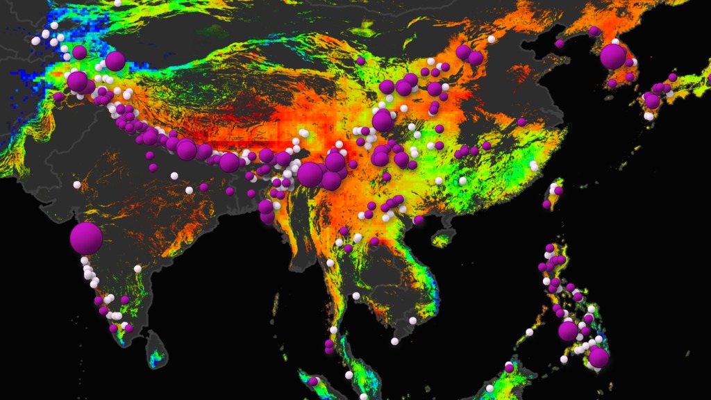

Together, we can build a clearer picture of landslides.


Together, we can build a clearer picture of landslides.
Landslides occur in all environments and can be caused by natural processes like rain or earthquakes, or by human processes such as construction or mining. They can cause unexpected loss of life and destruction of roads, buildings, and property. Researchers within the Hydrological Sciences Lab have created and are developing regional and global models to predict when and where landslides are likely to occur and how exposed communities are to damage from landslides. The focus is on creating a suite of open-source tools to map where landslides have occurred after a disaster strikes as well as build models to help communities better prepare for and respond to these disasters all over the world.
Report Landslides » Landslide Projects »Twitter: @LandslideReport
Facebook: LandslideReporter
SciStarter: Join us on our project page
Google Groups: Landslide Reporter Community
Landslides cause billions of dollars in infrastructural damage and thousands of deaths every year worldwide. Data on past landslide events guides future disaster prevention, but to date we do not have a global picture of exactly when and where landslides occur. NASA is building the biggest open global landslide inventory to address this problem, and the only way we can do this is with the help of citizen scientists like you!
The Cooperative Open Online Landslide Repository, or COOLR, is an open platform where scientists and citizen scientists can share landslide reports. See all landslide data from COOLR with other scientific data using the Landslide Viewer application. Want to contribute? Add to COOLR using our citizen science application, Landslide Reporter.
With more hands and your help, we can complete the global picture of landslides to prepare for and protect against future disasters.
Learn More »
Our NASA landslides team has been developing the Landslide Hazard Assessment for Situational Awareness (LHASA) model to provide an indication of where and when landslides may be likely around the world every 30 minutes. The team has also created a Landslide Susceptibility Map and the Global Landslide Catalog, which is the base for COOLR.
Our Projects »Landslides @ NASA is a project of NASA's Global Precipitation Measurement Mission (GPM) which use satellite data and citizen science data to model and inventory landslides around the world. We are based at NASA Goddard Space Flight Center (GSFC). Learn more about our publications and projects on the Resources page.
For any questions related to this system, please contact landslide_support@nccs.nasa.gov.