
Image Bottom Full

In 2005, global food production is under threat as key breadbaskets in Australia, Argentina, Brazil, Europe, Asia, Africa, and the United States suffer drought and heat waves outstrip the tolerance of crops.
Overview:
The Global Inventory Monitoring and Modeling Studies (GIMMS) group at NASA Goddard Space Flight Center (NASA/GSFC) provides United States Department of Agriculture/Foreign Agricultural Service (USDA/FAS) with global data stream of NDVI that spans over two decades (1981-present). The GIMMS NDVI is derived from measurements made by the Advanced Very High Resolution Radiometer (AVHRR), Global Area Coverage (GAC) data from the National Atmospheric Oceanic Administration (NOAA) polar orbiting series of satellites. GIMMS has inter-calibrated the data from the NOAA-AVHRR satellite series and performed atmospheric correction to minimize the effects of volcanic aerosols to produce and maintain a consistent NDVI archive. The NDVI archive from GIMMS provides the historic database for monitoring the response of vegetation to climatic conditions.
Linking the MODIS data to the long-term GIMMS AVHRR/NDVI, archive and SPOT Vegetation sensor data is a critical component of this project providing a consistent multi-source long-term data record for agricultural monitoring. This allows FAS analysts to compare current data with the spatial extent and severity of NDVI anomalies associated with heat stress, droughts and floods associated with crop failures.
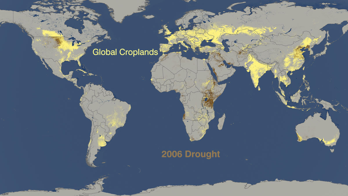 Drought in 2006 hits Africa, Argentina, China, United States, and Europe. A global drought in major wheat-producing countries coupled with the lowest world grain stocks in a quarter century are fueling rising wheat prices amid predictions of shortages.
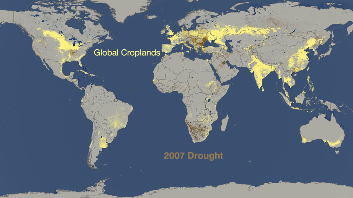 A moderate drought in the southern Great Plains, where most U.S. winter wheat is grown is shown in 2007 along with drought in Asia, Africa, Australia, Middle East, and Europe in 2007.
 Drought reaches the Middle East, Iraq, a soybean fields in Argentina, and croplands in California in 2008.
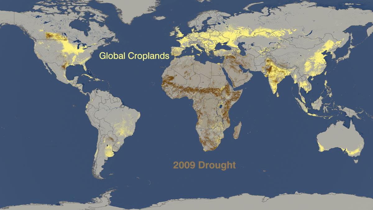 Droughts in Africa, India, Canada, Texas, California, Argentina, and China in 2009.