Browse Resources
Browse Resources
Primary Topic:
Subtopics:
Type:
Keywords:
Standards:
Summary:
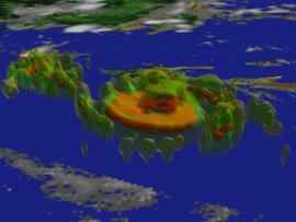
This website explores the technologies used to study and understand tropical cyclones.
Primary Topic:
Subtopics:
Type:
Keywords:
Summary:
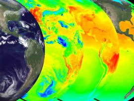
Explore the solar heating of the ocean in part one of a series on the water cycle. The animations show multiple views of the solar heating of the oceans, a picture of this first stage of water's cyclical journey from sea to air to land, and back again.
Primary Topic:
Subtopics:
Type:
Standards:
Keywords:
Summary:
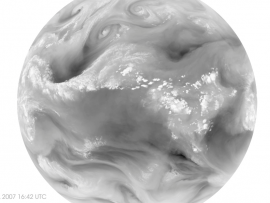
Water vapor - and with it energy - is carried around the globe by weather systems. This satellite image shows the distribution of water vapor over Africa and the Atlantic Ocean.
Primary Topic:
Subtopics:
Type:
Keywords:
Summary:
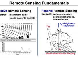
This diagram illustrates the differences between active and passive remote sensing. TRMM and GPM rely on active and passive instruments to measure the properties of precipitation from space.
Primary Topic:
Subtopics:
Type:
Keywords:
Summary:
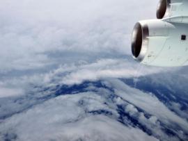
During the 2010 hurricane season, NASA deployed its piloted DC-8 and WB-57, and unmanned Global Hawk aircraft, arming hurricane researchers with the information needed to predict the growth and intensification of hurricanes.
Primary Topic:
Subtopics:
Type:
Keywords:
Summary:
NASA will dispatch two unmanned aircraft equipped with specialized instruments high above tropical cyclones in the Atlantic Ocean basin. These "severe storm sentinels" will investigate the processes that underlie hurricane formation and intensity change.
Primary Topic:
Subtopics:
Type:
Keywords:
Summary:
This NASA video segment highlights the impact of drought on a global scale. Viewers learn that during a drought the risk of fire increases. Fire produces soot and ash that travel across continents via the trade winds.
Primary Topic:
Subtopics:
Type:
Keywords:
Summary:
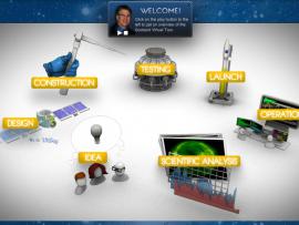
Learn about the life cycle of a satellite at Goddard Space Flight Center. This interactive 'tour' starts with the Idea phase and goes through the whole process ofa NASA satellite mission. This tour is an interesting introduction to the engineering process
Primary Topic:
Subtopics:
Type:
Keywords:
Summary:
View recent data for air temperature, carbon dioxide, carbon monoxide, sea level, ozone, ice and water using an interactive viewer. You can also follow NASA's satellites and learn how they collect critical data about Earth's atmosphere, land, and oceans.
Primary Topic:
Subtopics:
Type:
Standards:
Keywords:
Summary:
If the Earth continues to warm, what does that mean for hurricanes and their intensity? Your job is to look at past hurricane data by researching the intensity and frequency of hurricanes using the Live Access Server and several Internet sites.


