Browse Earth Systems Resources
Browse Earth Systems Resources
Primary Topic:
Subtopics:
Type:
Summary:
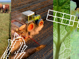
NASA’s Earth observations have a significant impact on the food we eat and drink. The NASA At Your Table campaign creates awareness of the many ways in which these data are being used by a variety of stakeholders to help get food and drink to your table..

Primary Topic:
Subtopics:
Type:
Summary:
A collection of resources exploring how NASA satellites like GPM can help monitor and predict Earth's climate.
Primary Topic:
Subtopics:
Type:
Summary:
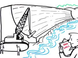
In this IQuest, you will explore resources to help you learn about the Sentinel-6 Michael Freilich satellite, the science behind sea level rise, and the STEM related careers of several of the scientists and engineers involved with this effort.
Primary Topic:
Subtopics:
Type:
Keywords:
Summary:
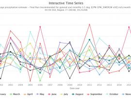
Did you know NASA has satellites that observe rain and snow all over the world? With this activity you can access NASA data to see how much precipitation was observed by satellites for your location any time from June 2000 to the present.

Primary Topic:
Subtopics:
Type:
Standards:
Keywords:
Summary:
The water cycle may seem simple on the surface, but there are many different ways to move through the process. This page has a few different versions of a Water Cycle Dice game to teach students about the complexities of water in Earth's system.

Primary Topic:
Subtopics:
Type:
Keywords:
Summary:
The monsoon is a seasonal rain and wind pattern that occurs over South Asia (among other places). Through NASA satellites and models we can see the monsoon patterns like never before.

Primary Topic:
Subtopics:
Type:
Summary:
An educational brochure which explores the importance of fresh water to life on Earth and how NASA is monitoring and studying precipitation using satellites like GPM.

Primary Topic:
Subtopics:
Type:
Keywords:
Summary:
This lesson uses cubes as a way to graph precipitation data to compare the precipitation averages and seasonal patterns for several different locations. There are several variations to accommodate various ages and ability levels.

Primary Topic:
Subtopics:
Type:
Keywords:
Summary:
In this program, GPM mission scientists and education specialists talk about watersheds and related educational resources.

Primary Topic:
Subtopics:
Type:
Keywords:
Summary:
This web seminar provided a robust understanding on the science behind Earth’s water cycle, while also demonstrating multiple possibilities for infusing water-related concepts into the curriculum.