Search
Primary tabs
Search
Your search for "temperature" gave back 36 results.

Primary Topic:
Subtopics:
Type:
Summary:
Use this iQuest to find out about predictions for the 2019 hurricane season and discover how hurricanes form. You will also learn how NASA satellite data is being used to help predict, monitor, and respond to these deadly storms.
Primary Topic:
Subtopics:
Type:
Standards:
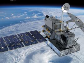
Summary:
This video, "Our Wet Wide World", provides an overview of the Global Precipitation Measurement Mission and its goals.

Primary Topic:
Subtopics:
Type:
Keywords:
Summary:
NASA will dispatch two unmanned aircraft equipped with specialized instruments high above tropical cyclones in the Atlantic Ocean basin. These "severe storm sentinels" will investigate the processes that underlie hurricane formation and intensity change.

Primary Topic:
Type:
Summary:
The water, or hydrologic, cycle describes the pilgrimage of water as water molecules make their way from the Earth’s surface to the atmosphere and back again, in some cases to below the surface.

Primary Topic:
Subtopics:
Type:
Keywords:
Summary:
View recent data for air temperature, carbon dioxide, carbon monoxide, sea level, ozone, ice and water using an interactive viewer. You can also follow NASA's satellites and learn how they collect critical data about Earth's atmosphere, land, and oceans.

Primary Topic:
Type:
Summary:
Mr. Olawale Oluwafemi is a member of the GLOBE Science Working Group and Lead, GPM-GLOBE Science Field Campaign Team.