Browse Technology Resources
Browse Technology Resources

Primary Topic:
Subtopics:
Type:
Keywords:
Summary:
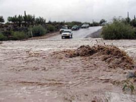
See Landsat images before and after these natural disasters.
Primary Topic:
Subtopics:
Type:
Keywords:
Summary:
Faisal Hossain, a civil and environmental engineering professor at Tennessee Technological University, uses NASA satellite data to help Bangladeshi authorities monitor their water resources and prepare for water-related disasters.

Primary Topic:
Subtopics:
Type:
Keywords:
Summary:
Find out how scientists use the distinct sounds made underwater by different size raindrops to measure rainfall.

Primary Topic:
Subtopics:
Type:
Standards:
Summary:
This problem-based learning module takes students through a real-world scenario drought in Texas and has them use satellite images and other actual data to answer questions about how Texas and other states should respond to the situation.

Primary Topic:
Subtopics:
Type:
Keywords:
Summary:
This website explores NASA's role in characterizing, understanding and predicting climate variability and change.

Primary Topic:
Subtopics:
Type:
Keywords:
Summary:
This website offer teachers and their students some background on how NASA is supporting the study of Earth's weather systems. There is a good image of TRMM data being used to understand tropical storms, and links to other websites with additional info.

Primary Topic:
Subtopics:
Type:
Standards:
Keywords:
Summary:
In this lesson, weather data from ground-based and satellite observations are analyzed for a real world application -- to plan a high mountain retreat in Tibet.