Browse Floods Resources
Browse Floods Resources
Primary Topic:
Subtopics:
Type:
Summary:
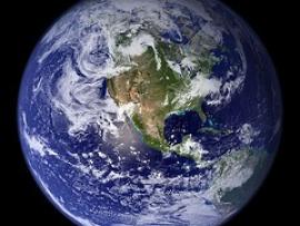
This interactive lesson will allow you to explore Earth’s freshwater resources. You will learn how NASA's Global Precipitation Measurement mission is helping us better understand our most valuable natural resource.

Primary Topic:
Subtopics:
Type:
Standards:
Summary:
This web eBook, developed in collaboration with the World Bank Group, explores water on Earth and how NASA observes and measures it.

Primary Topic:
Subtopics:
Type:
Keywords:
Summary:
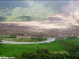
GPM Application Science Lead, Dr. Dalia Kirschbaum, explains how landslides and floods occur, and how satellite imagery is used in understanding these disasters.

Primary Topic:
Subtopics:
Type:
Keywords:
Summary:
GPM Master Teachers and Pilot Teachers showed their students the data animation depicting six months of global precipitation, and asked their students to share their questions for NASA scientists about this new global portrait of rain and snow.

Primary Topic:
Subtopics:
Type:
Keywords:
Summary:
Researchers need accurate and timely rainfall information to better understand and model where and when severe floods, frequent landslides and devastating droughts may occur, and GPM’s global rainfall data will help provide that information.

Primary Topic:
Subtopics:
Type:
Keywords:
Summary:
This is an introductory lesson to acquaint middle school students to many aspects of a serious and common natural disaster; flooding. Students will be directed to visit websites where they will interact with various types of media.

Primary Topic:
Subtopics:
Type:
Summary:
Learn how the satellite, Jason 2, is able to use radar waves to determine the height of sea levels and evaluate the effects of global warming.

Primary Topic:
Subtopics:
Type:
Summary:
Part 4 of a 4 part webquest that teaches the basics of precipitation science and technology. Prepares students for the GPM Anime Contest.
Primary Topic:
Subtopics:
Type:
Keywords:
Summary:
This article explains how NASA scientists use TRMM satellite rainfall data to help predict and prepare for landslides.

Primary Topic:
Subtopics:
Type:
Standards:
Keywords:
Summary:
Heavy spring rains and snowmelt led to devastating floods along the Mississippi River in May 2011. Landsat 5 flew over the Mississippi River on May 10, 2011, giving a distinct view of the extraordinary extent of the flooding.