Browse Formal Resources
Browse Formal Resources
Primary Topic:
Subtopics:
Type:
Keywords:
Summary:
Students will learn about how NASA’s Earth observing satellites are helping us better understand Earth’s freshwater resources and help farmers with agriculture.
Primary Topic:
Subtopics:
Type:
Keywords:
Summary:
Students will learn about how NASA’s Earth observing satellites are helping us better understand Earth’s freshwater resources and help farmers with agriculture.
Primary Topic:
Subtopics:
Type:
Keywords:
Summary:
Students will learn about how NASA’s Earth observing satellites are helping us better understand Earth’s freshwater resources and help farmers with agriculture.
Primary Topic:
Subtopics:
Type:
Keywords:
Summary:
Students will learn about how NASA’s Earth observing satellites are helping us better understand Earth’s freshwater resources and help farmers with agriculture.
Primary Topic:
Subtopics:
Type:
Keywords:
Summary:
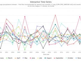
Did you know NASA has satellites that observe rain and snow all over the world? With this activity you can access NASA data to see how much precipitation was observed by satellites for your location any time from June 2000 to the present.
Primary Topic:
Subtopics:
Type:
Summary:
Use this iQuest to find out about predictions for the 2019 hurricane season and discover how hurricanes form. You will also learn how NASA satellite data is being used to help predict, monitor, and respond to these deadly storms.
Primary Topic:
Subtopics:
Type:
Standards:
Keywords:
Summary:
This video explains why the size and shape of raindrops in a cloud matters to scientists, and how the Global Precipitation Measurement Mission is able to provide these measurements from space.
Primary Topic:
Subtopics:
Type:
Keywords:
Summary:
This lesson uses cubes as a way to graph precipitation data to compare the precipitation averages and seasonal patterns for several different locations. There are several variations to accommodate various ages and ability levels.
Primary Topic:
Subtopics:
Type:
Standards:
Keywords:
Summary:
This data exercise has students look up precipitation ground data and satellite data for a site in Washington State and do a comparison using a data table and a graph. The activity is expected to take about 45 minutes.
Primary Topic:
Subtopics:
Type:
Keywords:
Summary:
You will learn how we measure rain and snow from the ground and from space using satellites, and why we need to check the data using ground validation. This particularly relates to the OLYMPEX Field Campaign.


