Browse General Resources
Browse General Resources
Primary Topic:
Subtopics:
Type:
Keywords:
Summary:
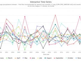
Did you know NASA has satellites that observe rain and snow all over the world? With this activity you can access NASA data to see how much precipitation was observed by satellites for your location any time from June 2000 to the present.

Primary Topic:
Subtopics:
Type:
Summary:
Use this iQuest to find out about predictions for the 2019 hurricane season and discover how hurricanes form. You will also learn how NASA satellite data is being used to help predict, monitor, and respond to these deadly storms.
Primary Topic:
Subtopics:
Type:
Summary:
This interactive lesson will allow you to explore Earth’s freshwater resources. You will learn how NASA's Global Precipitation Measurement mission is helping us better understand our most valuable natural resource.

Primary Topic:
Subtopics:
Type:
Standards:
Keywords:
Summary:
Step by step instructions and a parts list to build your own LEGO model of GPM precipitation data collected from Hurricane Irma on 9/5/17.

Primary Topic:
Subtopics:
Type:
Summary:
For the first time in 360 degrees, this data visualization takes you inside a hurricane. The precipitation satellite has an advanced radar that measures both liquid and frozen water. Click and drag to look around.

Primary Topic:
Subtopics:
Type:
Summary:
Requires access to a 3D printer. Learn how to use our 3D printed GPM data to teach about the structure of storms.

Primary Topic:
Type:
Summary:
In this webquest you will learn how vectors- like mosquitoes and ticks- can indeed cause sickness and in some cases even death. You will explore some resources to learn more about these diseases and how you can help with efforts to reduce them.

Primary Topic:
Subtopics:
Type:
Standards:
Keywords:
Summary:
NASA researchers use a combination of satellite observations to re-create multi-dimensional pictures of hurricanes and other major storms in order to study complex atmospheric interactions. In this video, they applied those techniques to Hurricane Matthew

Primary Topic:
Subtopics:
Type:
Standards:
Summary:
This web eBook, developed in collaboration with the World Bank Group, explores water on Earth and how NASA observes and measures it.

Primary Topic:
Subtopics:
Type:
Standards:
Keywords:
Summary:
GPM Project Scientist Gail Skofronick-Jackson explains why all snowflakes have six sides and how the Global Precipitation Measurement Mission can measure falling snow from space.