Browse Resources
Browse Resources

Primary Topic:
Subtopics:
Type:
Keywords:
Summary:
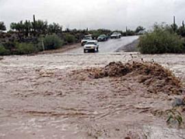
See Landsat images before and after these natural disasters.

Primary Topic:
Subtopics:
Type:
Keywords:
Summary:
View before and after images of natural disasters and human impact in various locations around the world.
Primary Topic:
Subtopics:
Type:
Keywords:
Summary:
Faisal Hossain, a civil and environmental engineering professor at Tennessee Technological University, uses NASA satellite data to help Bangladeshi authorities monitor their water resources and prepare for water-related disasters.

Primary Topic:
Subtopics:
Type:
Standards:
Keywords:
Summary:
Water vapor - and with it energy - is carried around the globe by weather systems. This satellite image shows the distribution of water vapor over Africa and the Atlantic Ocean.

Primary Topic:
Subtopics:
Type:
Standards:
Keywords:
Summary:
This flash animation takes viewers through four aspects of the water cycle: rain, water storage, vapor, and clouds.

Primary Topic:
Subtopics:
Type:
Keywords:
Summary:
View the latest data on the vital signs of the planet, including arctic sea ice levels, carbon dioxide, sea levels, global temperature and land ice.

Primary Topic:
Subtopics:
Type:
Keywords:
Standards:
Summary:
An educational outreach program allowing middle school students to take pictures of our Earth from a digital camera on board the International Space Station. Educators must register in order to participate in EarthKAM missions and request photos of Earth.

Primary Topic:
Subtopics:
Type:
Standards:
Keywords:
Summary:
Animation that demonstrates the global coverage of the GPM Constellation of satellites.

Primary Topic:
Subtopics:
Type:
Keywords:
Summary:
An activity in which students will cut and fold paper to create a 3D sphere which displays precipitation climatology.

Primary Topic:
Subtopics:
Type:
Standards:
Keywords:
Summary:
Engineers from the Japan Aerospace Exploration Agency (JAXA) and NASA Goddard Space Flight Center in Greenbelt, Md. oversee the arrival and unpacking of the dual-frequency Precipitation Radar.