Browse Resources
Browse Resources
Primary Topic:
Subtopics:
Type:
Summary:
Learn how the satellite, Jason 2, is able to use radar waves to determine the height of sea levels and evaluate the effects of global warming.
Primary Topic:
Subtopics:
Type:
Standards:
Keywords:
Summary:
The oceans are mostly composed of warm salty water near the surface over cold, less salty water in the ocean depths. These two regions don't mix except in certain special areas, which creates a large slow current called the thermohaline circulation.
Primary Topic:
Subtopics:
Type:
Keywords:
Summary:
Satellite Meteorology learning modules provide scientists and educators with exciting activities and hands-on tools for investigation, inquiry, analysis and stewardship.
Primary Topic:
Subtopics:
Type:
Keywords:
Summary:
Learn how scientists use a satellite called CERES to study the clouds and monitor Earth's climate changes.
Primary Topic:
Subtopics:
Type:
Summary:
Part 4 of a 4 part webquest that teaches the basics of precipitation science and technology. Prepares students for the GPM Anime Contest.
Primary Topic:
Subtopics:
Type:
Keywords:
Summary:
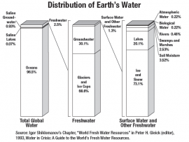
This classroom activity (originally developed for the GPM Poster) will teach students about the value of Earth's freshwater resources and how important it is to study how water is transferred and stored.
Primary Topic:
Subtopics:
Type:
Standards:
Keywords:
Summary:
This booklet explains the basics of weather satellites and contains activities to explain questions like "How does a satellite stay up in space without falling back to Earth? "
Primary Topic:
Subtopics:
Type:
Keywords:
Summary:
How do hurricanes get their energy? NASA hurricane scientist Dr. Jeff Halverson explains how hurricanes draw energy from the ocean surface.
Primary Topic:
Subtopics:
Type:
Keywords:
Summary:
During the past decade, groundwater beneath the northern Indian states of Punjab, Haryana, and Rajasthan has decreased by more than 88 million acre-feet. Using NASA's twin GRACE satellites, scientists determined the rate of groundwater change in India.
Primary Topic:
Subtopics:
Type:
Standards:
Keywords:
Summary:
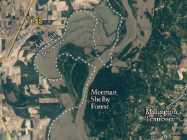
Heavy spring rains and snowmelt led to devastating floods along the Mississippi River in May 2011. Landsat 5 flew over the Mississippi River on May 10, 2011, giving a distinct view of the extraordinary extent of the flooding.


