Browse GPM Original Resource Resources
Browse GPM Original Resource Resources
Primary Topic:
Subtopics:
Type:
Keywords:
Summary:
GPM Application Science Lead, Dr. Dalia Kirschbaum, explains how landslides and floods occur, and how satellite imagery is used in understanding these disasters.
Primary Topic:
Subtopics:
Type:
Standards:
Keywords:
Summary:
GPM Application Science Lead, Dr. Dalia Kirschbaum, discusses how GPM observes hurricanes from space, as well as the formation process and properties of these hurricanes.
Primary Topic:
Subtopics:
Type:
Keywords:
Summary:
GPM Project Scientist Dr. Gail Skofronick-Jackson and Deputy Project Scientist Dr. George Huffman narrate a look at the new GPM IMERG global dataset.
Primary Topic:
Type:
Summary:
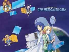
Coming soon - "Raindrop Tales: GPM Meets Mizu-chan" - an educational comic based on the winning characters from our GPM Anime Challenge.
Primary Topic:
Subtopics:
Type:
Keywords:
Summary:
GPM Master Teachers and Pilot Teachers showed their students the data animation depicting six months of global precipitation, and asked their students to share their questions for NASA scientists about this new global portrait of rain and snow.
Primary Topic:
Subtopics:
Type:
Standards:
Keywords:
Summary:
The purpose of this lesson is to provide students with experience creating models of landforms and bodies of water. Students review the characteristics of landforms and bodies of water in an active game, and then make models of these.
Primary Topic:
Subtopics:
Type:
Standards:
Keywords:
Summary:
The purpose of this lesson is to expose elementary level students to the practice of “developing and using models” as students explore and identify landforms and bodies of water on a map of the world. It is anticipated that this lesson will take one hour.
Primary Topic:
Subtopics:
Type:
Keywords:
Summary:
A video describing how the GPM constellation turns observed radiances and reflectivities of global precipitation into data products.
Primary Topic:
Subtopics:
Type:
Standards:
Keywords:
Summary:
This is the first of three lessons that have been developed to teach students about Earth’s water cycle, the importance of freshwater resources, and how NASA studies water in Earth’s systems.
Primary Topic:
Subtopics:
Type:
Keywords:
Summary:
This short video, derived from the Science on a Sphere film "Water Falls", explores how Earth's freshwater resources are allocated and used.


