Browse Freshwater Resources Resources
Browse Freshwater Resources Resources
Primary Topic:
Subtopics:
Type:
Standards:
Keywords:
Summary:
In this promotional video NASA scientists discuss why it is so important to study and track Earth's freshwater resources, and explain the purpose of the Global Precipitation Measurement mission.
Primary Topic:
Subtopics:
Type:
Keywords:
Standards:
Summary:
An educational website with activities, resources, and games to teach kids of all ages about Earth's systems, water cycle, weather and climate.
Primary Topic:
Subtopics:
Type:
Keywords:
Summary:
This website describes a study that is being conducted to understand the complexities of rainfall patterns and their effects on food security and human mobility.
Primary Topic:
Subtopics:
Type:
Keywords:
Summary:
Faisal Hossain, a civil and environmental engineering professor at Tennessee Technological University, uses NASA satellite data to help Bangladeshi authorities monitor their water resources and prepare for water-related disasters.
Primary Topic:
Subtopics:
Type:
Keywords:
Summary:
This NASA video segment highlights the impact of drought on a global scale. Viewers learn that during a drought the risk of fire increases. Fire produces soot and ash that travel across continents via the trade winds.
Primary Topic:
Subtopics:
Type:
Standards:
Keywords:
Summary:
Design and build a water filtration system and collect data to compare water before and after filtration.
Primary Topic:
Subtopics:
Type:
Standards:
Keywords:
Summary:
Understanding the mechanisms behind potential climate changes will allow accurate predictions of impacts to human health and the social and political factors which will affect the well-being of millions of Earth’s inhabitants.
Primary Topic:
Subtopics:
Type:
Standards:
Summary:
This problem-based learning module takes students through a real-world scenario drought in Texas and has them use satellite images and other actual data to answer questions about how Texas and other states should respond to the situation.
Primary Topic:
Subtopics:
Type:
Keywords:
Summary:
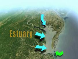
Learn how NASA uses Earth observing satellites to monitor conditions in the Chesapeake Bay over time. Information about pollution, eutrophication, land cover and watershed runoff helps water managers enact policies to improve the health of the Bay.
Primary Topic:
Subtopics:
Type:
Standards:
Keywords:
Summary:
One of the biggest changes to global agriculture is less about the food itself as it is about the water we use to grow it. In some areas, farmers are using freshwater resources - including groundwater - at an alarming rate.


