Search
Primary tabs
Search
Your search for "radar" gave back 31 results.
Primary Topic:
Subtopics:
Type:
Standards:
Keywords:
Summary:
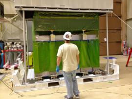
Engineers from the Japan Aerospace Exploration Agency (JAXA) and NASA Goddard Space Flight Center in Greenbelt, Md. oversee the arrival and unpacking of the dual-frequency Precipitation Radar.
Primary Topic:
Subtopics:
Type:
Keywords:
Summary:
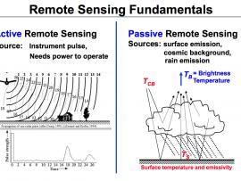
This diagram illustrates the differences between active and passive remote sensing. TRMM and GPM rely on active and passive instruments to measure the properties of precipitation from space.
Primary Topic:
Subtopics:
Type:
Keywords:
Summary:
You will learn how we measure precipitation from the ground and from space using satellites, and why we need to do ground validation of the satellite data. You will also learn about the OLYMPEX Field Campaign.
Primary Topic:
Subtopics:
Type:
Keywords:
Summary:
You will learn how we measure rain and snow from the ground and from space using satellites, and why we need to check the data using ground validation. This particularly relates to the OLYMPEX Field Campaign.
Primary Topic:
Subtopics:
Type:
Keywords:
Summary:
Part 3 of a 4 part webquest that teaches the basics of precipitation science and technology. Prepares students for the GPM Anime Contest.
Primary Topic:
Subtopics:
Type:
Summary:
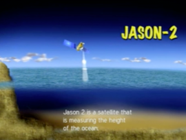
Learn how the satellite, Jason 2, is able to use radar waves to determine the height of sea levels and evaluate the effects of global warming.
Primary Topic:
Subtopics:
Type:
Keywords:
Summary:
This 17 page flyer provides an overview of the GPM Mission. It describes the technologies used to measure precipitation and the missions scientific goals and societal applications.
Primary Topic:
Subtopics:
Type:
Summary:
For the first time in 360 degrees, this data visualization takes you inside a hurricane. The precipitation satellite has an advanced radar that measures both liquid and frozen water. Click and drag to look around.
Primary Topic:
Subtopics:
Type:
Standards:
Keywords:
Summary:
Using satellites, lasers, and radar in space, and dedicated researchers on the ground, NASA is studying the Earth's ice and water to better understand how sea level rise might affect us all.
Primary Topic:
Subtopics:
Type:
Standards:
Keywords:
Summary:
'Towers in the Tempest' is a 4.5 minute narrated animation that explains recent scientific insights into how hurricanes intensify. This intensification can be caused by a phenomenon called a 'hot tower'.


