Search
Primary tabs
Search
Your search for "satellite" gave back 103 results.

Primary Topic:
Subtopics:
Type:
Keywords:
Summary:
Learn about the life cycle of a satellite at Goddard Space Flight Center. This interactive 'tour' starts with the Idea phase and goes through the whole process ofa NASA satellite mission. This tour is an interesting introduction to the engineering process

Primary Topic:
Subtopics:
Type:
Keywords:
Summary:
A video describing how the GPM constellation turns observed radiances and reflectivities of global precipitation into data products.

Primary Topic:
Subtopics:
Type:
Standards:
Keywords:
Summary:
Engineers from the Japan Aerospace Exploration Agency (JAXA) and NASA Goddard Space Flight Center in Greenbelt, Md. oversee the arrival and unpacking of the dual-frequency Precipitation Radar.

Primary Topic:
Subtopics:
Type:
Summary:
Learn how the satellite, Jason 2, is able to use radar waves to determine the height of sea levels and evaluate the effects of global warming.

Primary Topic:
Subtopics:
Type:
Keywords:
Summary:
Learn how scientists use a satellite called CERES to study the clouds and monitor Earth's climate changes.

Primary Topic:
Subtopics:
Type:
Keywords:
Summary:
This My NASA Data lesson plan takes students through data from the GRACE satellite mission to help them understand where regions around the globe may experience a change in their freshwater availability.

Primary Topic:
Subtopics:
Type:
Standards:
Keywords:
Summary:
Water vapor - and with it energy - is carried around the globe by weather systems. This satellite image shows the distribution of water vapor over Africa and the Atlantic Ocean.

Primary Topic:
Subtopics:
Type:
Summary:
Build a paper model of the GPM Core Observatory and learn about the technology the satellite will use to measure precipitation from space.
Primary Topic:
Subtopics:
Type:
Summary:
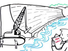
In this IQuest, you will explore resources to help you learn about the Sentinel-6 Michael Freilich satellite, the science behind sea level rise, and the STEM related careers of several of the scientists and engineers involved with this effort.

Primary Topic:
Subtopics:
Type:
Standards:
Keywords:
Summary:
NASA researchers use a combination of satellite observations to re-create multi-dimensional pictures of hurricanes and other major storms in order to study complex atmospheric interactions. In this video, they applied those techniques to Hurricane Matthew