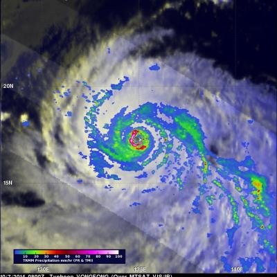
Widespread Rainfall With Super Typhoon Vongfong
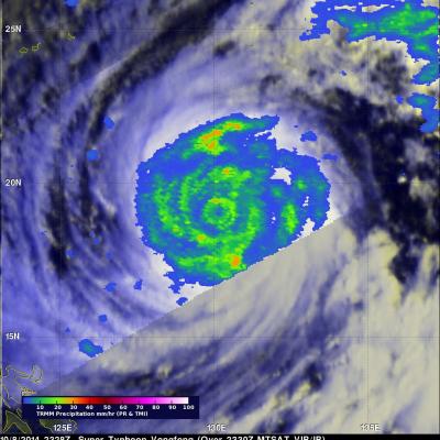
Vongfong was a super typhoon with wind maximum sustained winds of 145 kts (167 mph) when the TRMM satellite flew over on October 8, 2014 at 2328 UTC. Vongfong was the most powerful typhoon since super typhoon Haiyan that killed over 6,000 people after hitting the Philippines in November 2013. In the first image TRMM's Microwave Imager (TMI) shows that Vongfong was producing rainfall over a large area with heavy rainfall revealed in the eye wall and in multiple feeder bands. The small animation shows typhoon Vongfong's rainfall being overlaid on a MTSAT Visible/Infrared image. The Joint Typhoon