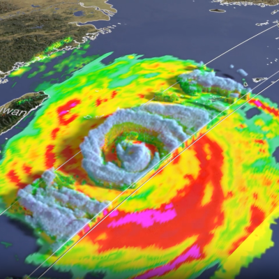
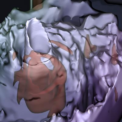
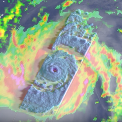
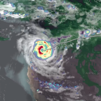
Extreme Weather News

Jump to a Year

2022 | 2021 | 2020 | 2019 | 2018

2017 | 2016 | 2015 | 2014 | 2013

2012 | 2011 | 2010 | 2009 | 2008

2007 | 2006 | 2005 | 2004 | 2003

2002

Screenshot of the IMERG animation showing rainfall totals from the atmospheric river in Jan. and Feb. 2024.
A pair of powerful atmospheric river events brought heavy precipitation across much of coastal California this week, resulting in record rainfall totals, extensive flooding, numerous landslides, hurricane-force winds, and power outages. These types of atmospheric river events that impact the U.S. West Coast are also known as the “Pineapple Express” due to their transport of moisture up from the Tropics originating around Hawaii. The first event had the greatest impact on northern and central California. It was initiated when a large low-pressure trough located in the northeast Pacific
jasper-screenshot.png
In mid-December 2023, the far north region of Australia’s Queensland state experienced heavy precipitation and flooding as a result of Tropical Cyclone Jasper, which made landfall on December 13 north of the town of Port Douglas. The Joint Typhoon Warning Center began issuing bulletins on Jasper on December 5 as it developed into a tropical depression over the Western South Pacific Ocean. By December 7, Jasper had strengthened to a Category 4-equivalent cyclone on the Saffir-Simpson scale as it tracked southwestward. By the time it made landfall on December 13, Jasper’s winds had weakened back
GPM Overpass of Hurricane Otis
After rapidly intensifying overnight, Hurricane Otis made landfall near Acapulco, Mexico around 1:25 a.m. CDT (06:25 UTC) on Wednesday Oct. 25 as a powerful Category 5 hurricane. Otis had maximum sustained winds estimated at 165 mph by the National Hurricane Center (NHC), making it the first Category 5 as well as the most powerful storm to hit the Pacific coast of Mexico on record. Otis formed into a tropical depression (TD 18-E) on the morning of Sunday Oct. 22 about 530 miles (850 km) south-southeast of Acapulco from a broad area of low pressure. The depression was moving slowly northward
GPM Overpass of Cyclone Bolaven
Typhoon Bolaven began as a tropical depression over the West Pacific Ocean on Oct. 7, 2023. On Oct. 10, Bolaven became a Typhoon and passed over the Mariana Islands as it tracked to the northwest. Bolaven then rapidly intensified over 12 hours from a Category 1 to a Category 5 storm on the Saffir-Simpson scale, starting around 12 UTC on Oct. 10. Several factors contributed to the rapid intensification, including modest shear in the atmosphere and warm sea-surface temperatures. This animation shows precipitation within Typhoon Bolaven around the time that rapid intensification began. The global
Map of IMERG precipitation estimates from recent flooding rainfall in Greece.
On Sept. 4, 2023, a low-pressure system developed over southeastern Europe that would lead to devastating floods over Greece and other parts of the region. The system was given the name “Daniel” by local meteorological agencies. Daniel was dynamically driven by strong cyclonic flow in the upper-level winds over southeastern Europe. The upper-levels winds combined with low-level winds from the northeast which supplied moisture from the unusually warm waters of the Aegean and Black Seas to central Greece. According to satellite infrared and microwave estimates from NASA's MUR and NOAA’s OISST v2