
Missions
NASA’s Precipitation Measurement Missions consist of TRMM and GPM. The Global Precipitation Measurement Mission (GPM) is an international satellite mission launched by NASA and JAXA on Feb. 27th, 2014 that is setting new standards for precipitation measurements worldwide. Using a network of satellites united by the GPM Core Observatory, GPM expands on the legacy of the Tropical Rainfall Measuring Mission (TRMM, 1998 - 2015) by providing high quality estimates of Earth’s rainfall and snowfall every 30 minutes.
![]()
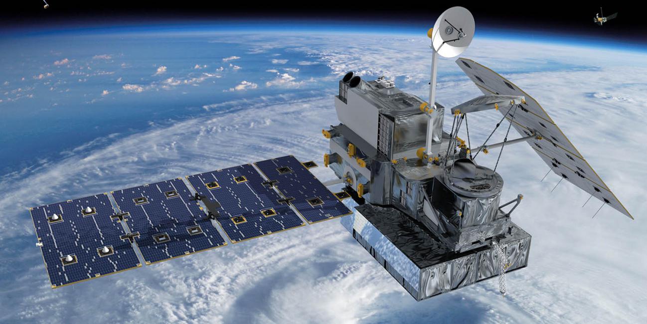
Global Precipitation Measurement Mission
The Global Precipitation Measurement (GPM) mission is an international network of satellites that provide the next-generation global observations of rain and snow. Building upon the success of the Tropical Rainfall Measuring Mission (TRMM), the GPM concept centers on the deployment of a “Core” satellite carrying an advanced radar / radiometer system to measure precipitation from space and serve as a reference standard to unify precipitation measurements from a constellation of research and operational satellites. Through improved measurements of precipitation globally, the GPM mission is helping to advance our understanding of Earth's water and energy cycle, improve forecasting of extreme events that cause natural hazards and disasters, and extend current capabilities in using accurate and timely information of precipitation to directly benefit society.
![]()
Tropical Rainfall Measuring Mission
TRMM was a research satellite in operation from 1997 to 2015 designed to improve our understanding of the distribution and variability of precipitation within the tropics as part of the water cycle in the current climate system. By covering the tropical and sub-tropical regions of the Earth, TRMM provided much needed information on rainfall and its associated heat release that helps to power the global atmospheric circulation that shapes both weather and climate. In coordination with other satellites in NASA's Earth Observing System, TRMM provided important precipitation information using several space-borne instruments to increase our understanding of the interactions between water vapor, clouds, and precipitation, that are central to regulating Earth's climate.
After over 17 years of productive data gathering, the instruments on TRMM were turned off on April 8, 2015. The spacecraft re-entered the Earth’s atmosphere on June 15, 2015, at 11:55 p.m. EDT, over the South Indian Ocean.
![]()
Ground Validation Field Campaigns
Looking ahead it is becoming apparent that the future of precipitation research is probably not one in which satellite data are used in isolation. Instead, integration of satellite precipitation measurements with ground observations, cloud resolving models (CRMs) and land surface data assimilation systems (LDAS) is likely to replace satellite-only precipitation products, particularly for forecasting and hydrological applications that require precipitation as input. This is already apparent in the analyzed precipitation products over the continental US and similar activities in Japan. Hence within this context, GPM validation activities should consider not only the satellite products, but the merged precipitation products based upon GPM data that embrace cloud resolving models and coupled land surface/cloud resolving models used in hydrologic applications. Such modeling components are also needed to improve the physical formulation of the radiometer algorithm over land and thus serve a dual role in the efforts described here.