Hide Date

Photograph of a landslide on a mountain.
Cooperative Open Online Landslide Repository What is COOLR? The Cooperative Open Online Landslide Repository, or COOLR, is an open platform where scientists and volunteers can share information on landslides. COOLR consists of two main components: Report-based data: Individual landslide reports from various sources, including: The Global Landslide Catalog (GLC), compiled by NASA staff The Landslide Reporter Catalog (LRC), compiled by volunteers Other report-based data, compiled by researchers outside NASA Event-based data: Landslide inventories associated with a specific triggering event or
Photograph of a landslide on a mountain.
What was the exact date the landslide occurred? Leave this blank if you are not sure which day it happened. What time did the landslide occur? Enter the approximate time of the landslide in the local time zone. If unknown, leave blank. Where did the landslide happen? This can be a street address, Latitude and Longitude (if known), or general description. Did it cause any damage? How much? Describe any casualties and damage to infrastructure, property, or the environment. Include numbers if possible. How do you know about the landslide? Indicate your source of information, such as personal
Thumbnail
GPM Precipitation & Applications Global Viewer NOTE: This app is intended to be viewed on a large computer monitor. Click Here to view Fullscreen This page is a demonstration of the PMM Precipitation and Applications Publisher API. To learn how to use the API for your own applications, please visit: https://pmmpublisher.pps.eosdis.nasa.gov/ https://pmmpublisher.pps.eosdis.nasa.gov/docs For More Information On: the GPM Precipitation products, please see: https://gpm.nasa.gov/data/directory the Global Landslide Nowcast, please visit: https://gpm.nasa.gov/applications/landslides
Group photo of attendees of the 2024 PMM Science Team Meeting, standing in front of a boat.
Above image: Attendees of the 2024 PMM Science Team Meeting.
Thumbnail
For the third consecutive year, NASA’s Global Precipitation Measurement Mission applications team and University of Coimbra’s Earth and Space Science Center (CITEUC Portugal) collaborated to host the GPM Mentorship Program. The 2024 initiative built on previous years' successes, supporting new and existing user communities and providing a tailored hands-on learning experience in using GPM data for applications. It gave participants an overview of state-of-the-art GPM satellite-based precipitation estimates and provided users with examples of applying GPM data to support real-world problems
Banner for the GPM 10-in-10 webinar series featuring the GPM satellite flying over Earth.
Nov. 14, 2024, 8:00 p.m. ET Overview As we finish celebrating the NASA / JAXA Global Precipitation Measurement (GPM) mission's 10 year anniversary, we'll take a look behind the scenes at how the GPM Outreach Team showcased the mission's science, technology, and applications over the years. We'll also look ahead to the exciting new plans for the future of NASA’s precipitation measurement missions! View the Resource Packet Speakers Kristen Weaver Kristen Weaver is the Deputy Coordinator for the GLOBE Observer project, which aims to extend the long-standing citizen science and science education
GPM Ground Validation webinar banner showing a large radar dish in front of a misty mountain during the early morning.
Oct 10, 2024, 8:00 p.m. ET Overview It is amazing that NASA’s Earth-observing satellites can collect data from around the globe to help us better understand and protect our home planet! Have you ever wondered how we compare the data we obtain from satellites with data we collect on the ground to ensure that satellites are accurate with their measurements? Join us to learn about ground validation efforts that must be completed to ensure that our global precipitation data is accurate. You will also learn how you can contribute to the vast array of freely available NASA-sponsored data through The
GPM Applications webinar banner
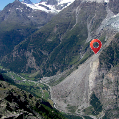
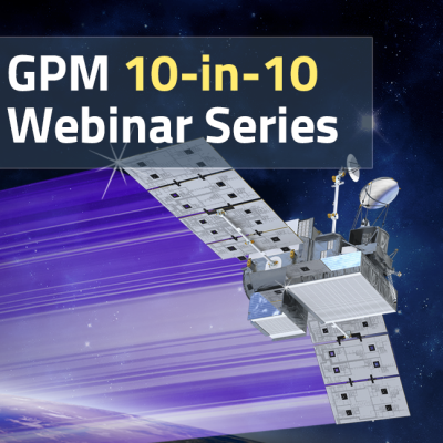
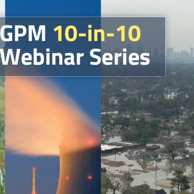
Did you know that GPM data has enabled people to better understand how water moves through our planet and make informed decisions that lead to improved outcomes for society? GPM continues to support a range of applications from water resource management, agriculture, vector- and water-borne disease monitoring, animal migration, tropical cyclone location and intensity estimation, hydropower management, flood and landslide monitoring and forecasting, and land system modeling, among others. Join us during this free webinar to learn about the multiple ways GPM is used throughout the world and gain a perspective from two GPM power users that help support weather forecasters and the ecological community.
Webinar 7 banner: PRecipitation Data
August 1, 2024, 8:00 p.m. ET Register Here Overview Every second of every day, NASA satellites are collecting data to help us better understand and protect our home planet. Have you ever wondered what kinds of data NASA collects and how you can access it? Join us and find out how and why we use Earth-observing satellites to collect data, where you can access this free and openly sourced data, and how various NASA-sponsored programs are helping make data understandable and accessible to everyone. Resources: Resource packet Speakers Elizabeth Joyner Elizabeth Joyner serves as Community