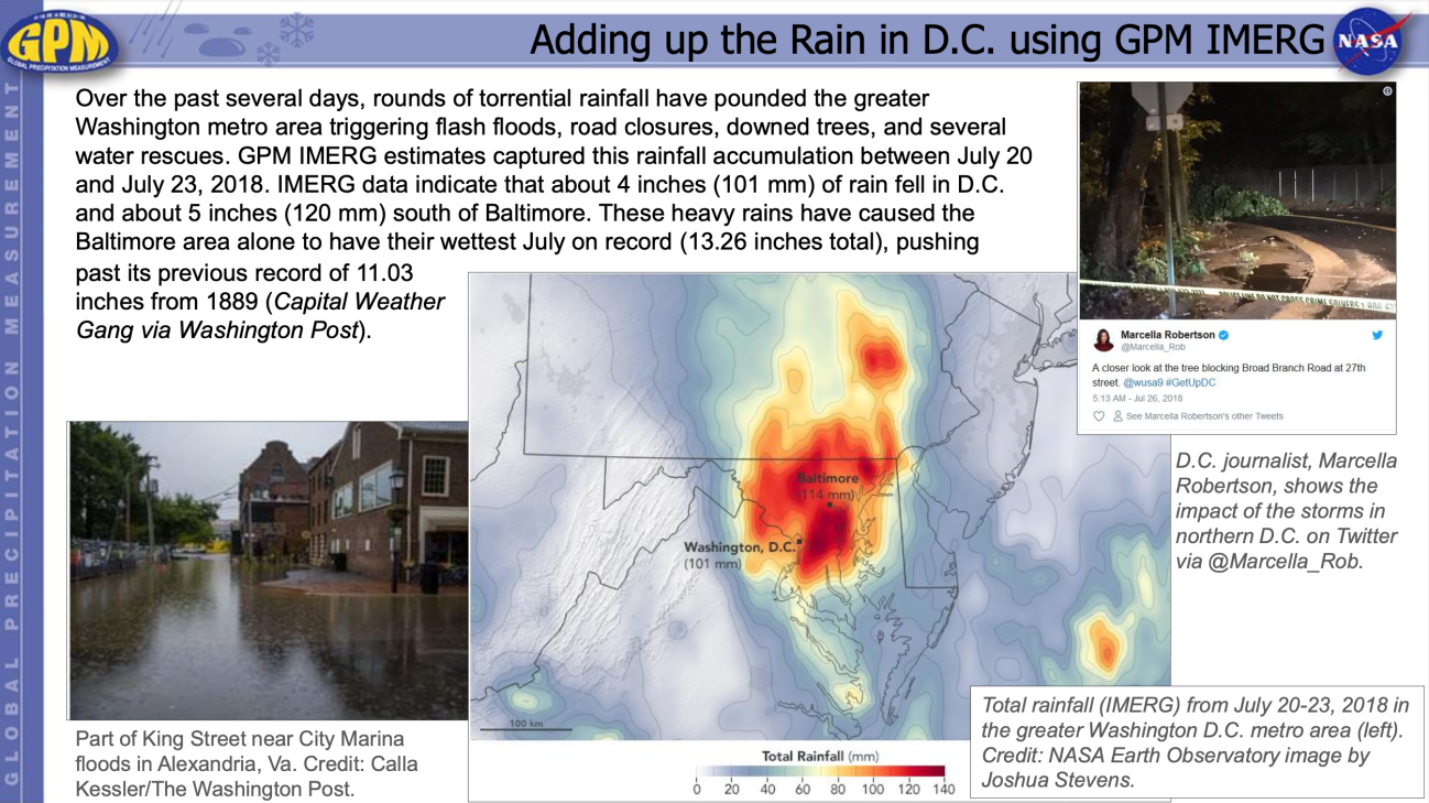
Using GPM Data for Ecological Management
Wednesday, February 6, 2019
The impacts of climate change are already having a profound effect on ecosystems. Changes in temperature and precipitation patterns affect species and communities in diverse ways, such as declines in species and species diversity, changing interactions between species, and modification of ecosystems. Effective ecosystem management is critical to maintaining and repairing the natural environments in order to reliably support human needs while conserving and sustaining ecological services and diversity. Satellite observations can provide critical information relevant to the distribution of ecosystems and their resident species. Natural resource managers and scientists use this information to understand patterns of biodiversity, how biodiversity is changing, drivers of changes, and to predict impacts of environmental changes on ecological systems. The Ecological Management applications focus area highlights research and decision making activities that use GPM satellite precipitation data to analyze and forecast changes that affect ecosystems and to develop effective resource management strategies.
Overview
The impacts of climate change are already having a profound effect on ecosystems. Changes in temperature and precipitation patterns affect species and communities in diverse ways, such as declines in species and species diversity, changing interactions between species, and modification of ecosystems. Effective ecosystem management is critical to maintaining and repairing the natural environments in order to reliably support human needs while conserving and sustaining ecological services and diversity. Satellite observations can provide critical information relevant to the distribution of ecosystems and their resident species. Natural resource managers and scientists use this information to understand patterns of biodiversity, how biodiversity is changing, drivers of changes, and to predict impacts of environmental changes on ecological systems. The Ecological Management applications focus area highlights research and decision making activities that use GPM satellite precipitation data to analyze and forecast changes that affect ecosystems and to develop effective resource management strategies.
Sections
GPM Data for Decision Making
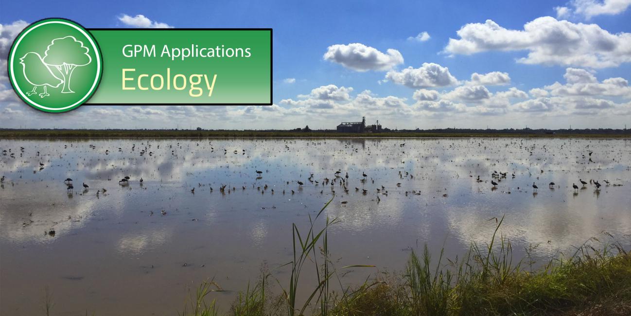
Image
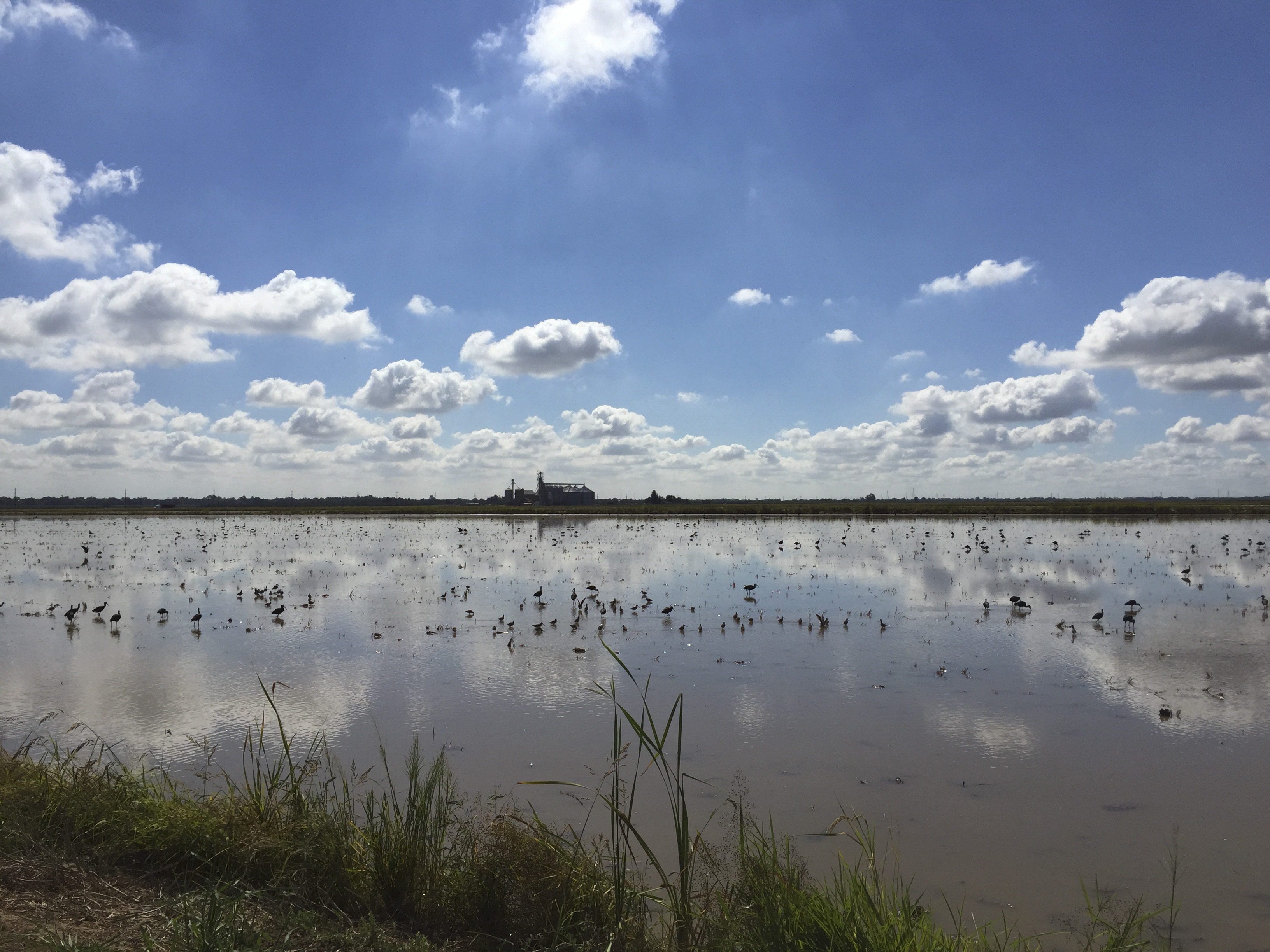
A rice field in California’s Central Valley is shallowly flooded to provide habitat and feeding grounds for migrating shorebirds, as part of the BirdReturns program.
Credit: Paul Spraycar/The Nature Conservancy
Biological diversity refers to the variety of all life on Earth, from genes to species, ecosystems, and biomes. Natural environmental parameters such as precipitation, temperature, elevation, nutrient availability, and salinity influence the number and type of species found in a region. Biodiversity is critical for maintaining balanced ecosystems and provides a plethora of ecosystem goods and services such as clean air, fresh water, waste removal, food, and medicines. The vantage point of space provides a unique perspective to observe Earth’s surfaces at local, regional, and global scales, as well as over time. Precipitation data from the GPM Mission can be used to study species distributions as well as environmental parameters that influence biodiversity.
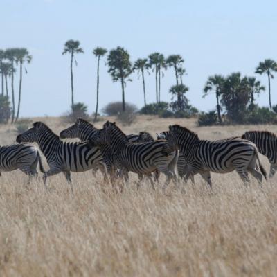
Image
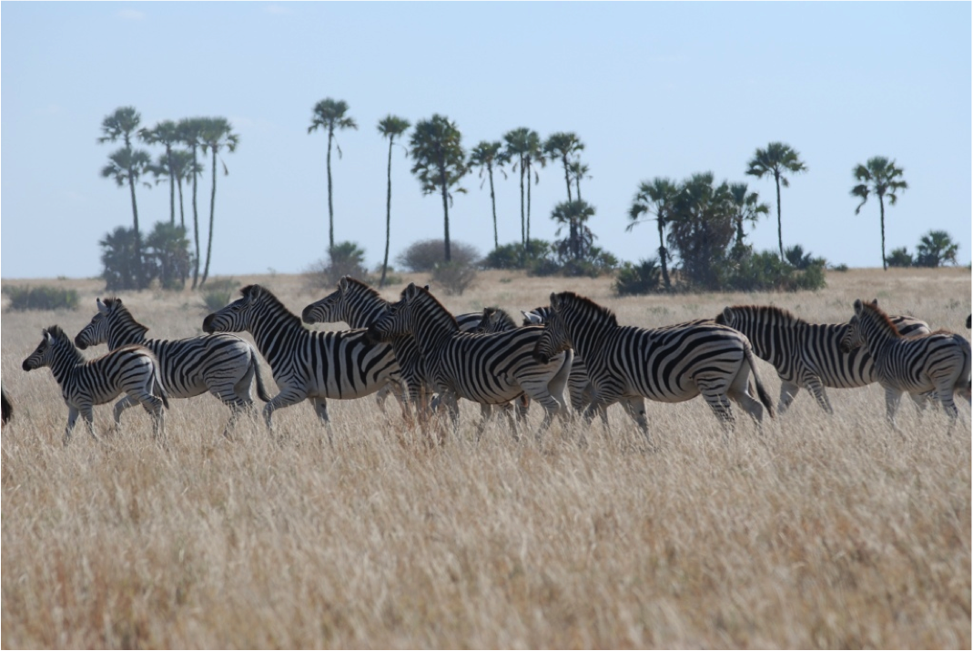
Zebras in the Makgadikgadi grasslands. Image Credit: Hattie Bartlam-Brooks
Ecological forecasting allows scientists to project the future impacts of environmental changes. The goal is to develop reliable, science-based information that allow decision makers to proactively plan effective resource management strategies as well as explore the anticipated outcomes of alternative strategies. In particular, researchers use a variety of Earth-observation datasets, including GPM data, in combination with other geographic and socioeconomic data to predict the impacts of environmental changes on ecosystems and biodiversity, both now and in the future. Decision makers then use these ecological forecasts to address issues related to biodiversity conservation and protected area management. Management actions can reduce or eliminate the impacts of environmental change on biodiversity, which in turn has significant socioeconomic implications.
Ecology Featured Resources

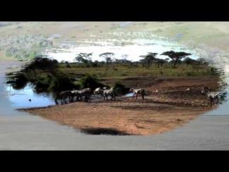
Botswana's Okavango Delta and the Makgadikgadi Salt Pans are two ends of a 360-mile round trip zebra migration, the second longest on Earth. In this animation, shades of red show dry areas, green represents vegetation, and the dots show GPS tracked zebras. The zebras begin at the Okavango Delta in late September. After the dry Southern hemisphere winter, November rains signal it is time to begin their two-week journey to the Salt Pans. The zebras feast on nutrient-rich grasses all summer, and return to the Delta as the rain peters out in April.
Fences blocked this zebra migration from 1968 to...