Using GPM Data for Development and Public Health
Monday, September 17, 2018
Precipitation extremes, from heavy rainfall to droughts, pose great risks to a country’s economic development and human health. Standing water and flooding resulting from heavy rainfall has created societal vulnerabilities to vector and waterborne disease outbreaks such as malaria, schistosomiasis, cholera, and chikungunya, among others. Drought and extreme heat conditions have been associated with a wide range of health hazards including degraded air and water quality. These meteorological extremes also impact the growth of cities such as damaging transportation networks and infrastructures, which in turn can play a role in human conflict and migration. The Development and Public Health applications area encourages the use of satellite precipitation data from the GPM mission to inform development and public health decisions, particularly involving socioeconomic development issues and infectious diseases.
Overview
Precipitation extremes, from heavy rainfall to droughts, pose great risks to a country’s economic development and human health. Standing water and flooding resulting from heavy rainfall has created societal vulnerabilities to vector and waterborne disease outbreaks such as malaria, schistosomiasis, cholera, and chikungunya, among others. Drought and extreme heat conditions have been associated with a wide range of health hazards including degraded air and water quality. These meteorological extremes also impact the growth of cities such as damaging transportation networks and infrastructures, which in turn can play a role in human conflict and migration. The Development and Public Health applications area encourages the use of satellite precipitation data from the GPM mission to inform development and public health decisions, particularly involving socioeconomic development issues and infectious diseases.
Sections
Image

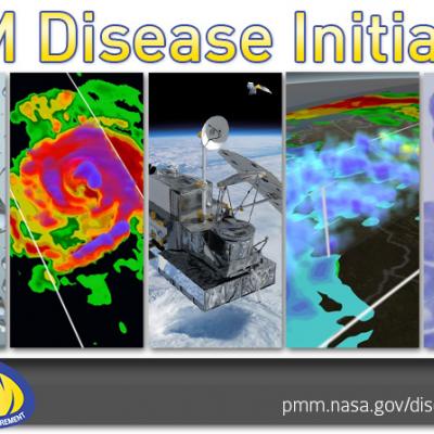
GPM Disease Initiative
Using satellite data from the GPM Mission to explore linkages between precipitation and vector-borne and water-related diseases is GPM Applications’ newest initiative. To learn more about this initiative, please click the link above to learn about past workshops, seminars, and participate in discussion at the Basecamp site, “Water-Related and Vector-Borne Disease Initiative”.
GPM Data for Decision Making
Image
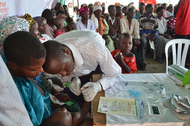
Women and children in rural Uganda look on as a service provider from a nearby health center provides malaria tests for communities on the lake's edge. Credit: MIT News, Kim Burns Case
Extreme precipitation and weather events that result in flooding, droughts, and hurricanes affect directly and indirectly the health of humans. For instance, heavy precipitation can create changes in the availability and quantity of freshwater resources as well as be a driver of disease migration such as malaria and cholera, among others. These effects pose a significant public health challenge globally. Many diseases and health effects can be minimized or avoided with sound mitigation and adaptation strategies. In developing regions with limited clean water infrastructure and health resources that are stretched thin, any advanced warning of potential health risks can make a huge difference in the health community’s response to help people in need.
Using satellite data to forecast disease outbreaks and other health effects is a relatively emerging field. Researchers and public health officials use NASA data sets from a number of satellites, including rainfall from GPM, to develop disease forecasts for the risk of water-borne and vector borne diseases across the globe, from Bangladesh to the United States. GPM’s global coverage and high frequency observations can even help locate areas at risk over short time-scale events like hurricane-induced flooding, which can cause sewage and waste-related health issues. Characterizing the patterns of extreme precipitation and the flooding or landslides that may happen as a result is also vital for understanding where, when and how populations may be impacted.
Image
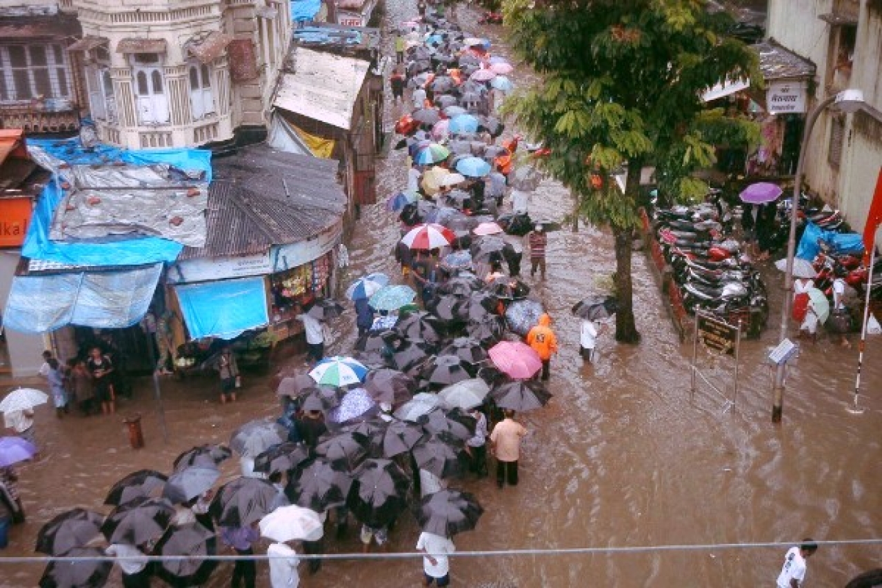
When it rains in Mumbai, infrastructure is the first casualty. Credit: Nagesh Ohal / India Today Group / Getty Images
Exposure to precipitation extremes from heavy rainfall to blizzards can impact thousands of people, posing a threat to society and the environment. The stress of water and snow could disrupt traffic, weaken road and building infrastructure, and could even disrupt solid waste removal and disposal, requiring frequent maintenance, repairs, and rebuilding. Extreme precipitation events could also lead to intrastate conflict and emigration as a result of unavailable freshwater resources and loss of personal property. Therefore, it is critically important to monitor and understand the impacts of precipitation extremes to reduce risks that may threaten a country’s development. Economists and urban planners among others can rely on GPM precipitation products, including the near-real-time Integrated Multi-satellitE Retrievals for GPM (IMERG) data product, to reduce uncertainty about the future performance of infrastructure systems and to understand impacts of precipitation extremes on society.
Health Featured Resources
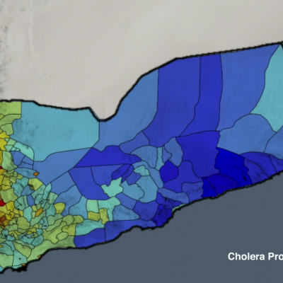
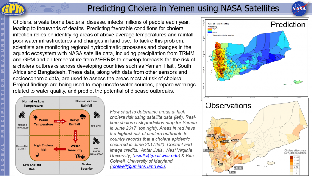
A new modeling approach using satellite data will likely to enhance our ability to develop cholera risk maps in several regions of the globe. The model (GCRM) is based on monthly air temperature, precipitation, availability of WASH (water, sanitation and hygiene) infrastructure, population density and severity of natural disaster. The outputs of GCRM can be visualized on 0.10x0.10, with the hope of improving the spatial scale as new data products are incorporated into the model.
Music: "A New Hope," Al Lethbridge, Atmosphere Music Ltd PRS; "Spirals within a Sphere," Adam Salkeld, Atmosphere...
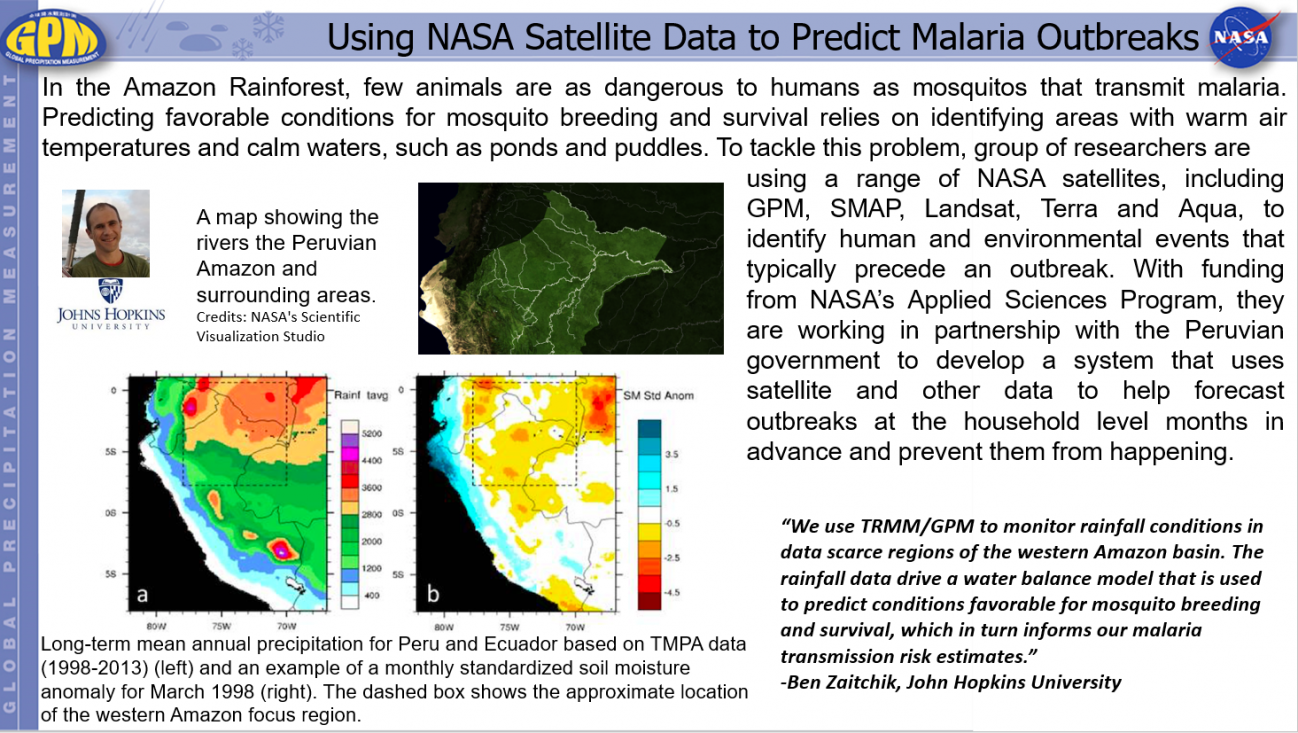
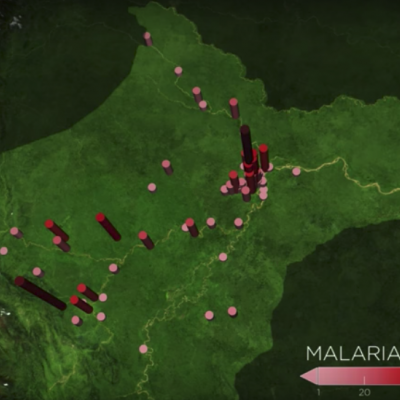
In the Amazon Rainforest, few animals are as dangerous to humans as mosquitos that transmit malaria. The tropical disease can bring on severe fever, headaches and chills and is particularly severe for children and the elderly and can cause complications for pregnant women. In rainforest-covered Peru the number of malaria cases has spiked such that, in the past five years, it has had on average the second highest rate in the South American continent. In 2014 and 2015 there were 65,000 reported cases in the country.
Containing malaria outbreaks is challenging because it is difficult to figure...