

Ground Validation
Looking ahead it is becoming apparent that the future of precipitation research is probably not one in which satellite data are used in isolation. Instead, integration of satellite precipitation measurements with ground observations, cloud resolving models (CRMs) and land surface data assimilation systems (LDAS) is likely to replace satellite-only precipitation products, particularly for forecasting and hydrological applications that require precipitation as input. This is already apparent in the analyzed precipitation products over the continental US and similar activities in Japan. Hence within this context, GPM validation activities should consider not only the satellite products, but the merged precipitation products based upon GPM data that embrace cloud resolving models and coupled land surface/cloud resolving models used in hydrologic applications. Such modeling components are also needed to improve the physical formulation of the radiometer algorithm over land and thus serve a dual role in the efforts described here.
This section provides access to ground validation activities supported by NASA's GPM Project and by GPM Partners around the world.
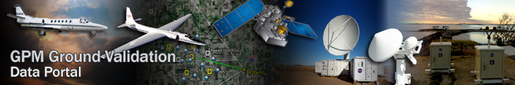
Ground Validation Data Portal
The GPM Ground Validation Data Portal provides access to a wide range of ground validation data collected and managed by the MSFC Disdrometer and Radar Observations of Precipitation (DROP) facility. Instrument descriptions are provided along with useful data analysis tools and points of contact.
- Ground Validation Data Homepage
- GPM Ground Validation Data Archive
- Field Campaign Data Archive Hosted at the GHRC DAAC
Validation Network Software and Data Products
The software that runs Data and the Validation Network (VN) is now open source. Validation Network data and end products are available. View documentation that describes the VN data, including the directory structure of the VN data archive:
- Validation Network Data Product User's Guide - Volume 1 (TRMM)
- Validation Network Data Product User's Guide - Volume 2 (GPM)
If you have questions about the data or software, please direct them to the Validation Network contacts. A recent peer-reviewed journal article on the Validation Network is available at the American Meteorological Society.
Ground Validation Science Implementation Plan
A Ground Validation Science Implementation Plan (GVSIP) has been drafted that summarizes the rationale and approach to GPM Ground Validation. The GVSIP includes information about field campaigns, instruments and data management that will be conducted in support of GPM algorithm development and product validation.
Ground Validation Ka/Ku Radar
The Dual-frequency Dual-polarized Doppler Radar (D3R) operates as a fully polarimetric, scanning weather radar system operating at the nominal frequencies of 13.91 GHz and 35.56 GHz covering a maximum range of 30 km (19 miles). The frequencies chosen allow close compatibility with the GPM Dual-frequency Precipitation Radar system. The D3R radar operates during the GPM ground validation field campaigns.
Field Campaigns
![]() ICE-POP
ICE-POP
February 2018 - March 2018, South Korea
The International Collaborative Experiments for Pyeongchang 2018 Olympic and Paralympic Winter Games (ICE-POP 2018) takes place during the Winter Olympics (February-March) of 2018 and focuses on the measurement, physics, and improved prediction of heavy orographic snow in the PyeongChang region of South Korea. ICE-POP is led by the Korean Meteorological Administration (KMA) as a component of the World Meteorological Organization’s (WMO) World Weather Research Program (WWRP) Research and Development and Forecast Demonstration Projects (RDP/FDP). The goals of ICE-POP are:
- Improvement of our understanding on severe weathers (snowfalls, visibility, rapid wind changes and gusts,) over complex terrain - Specially focus on the microphysical processes over complex terrain as well as the impact of the ocean on snow to extend the experience from SNOW-V10 and FROST- 2014.
- Improvement of the predictability of nowcasting and very-short-range forecasting with a few kilometer horizontal resolution - Development of NWP-based nowcasting, multi-scale data assimilation and time- lagged ensemble for VSRF, and radar reflectivity and visibility data assimilation
- Improvement of verification and evaluation methods for high resolution model considering complex terrain - Development of verification methods for high spatial and temporal variables with remote-sensing observation and non-traditional variables (visibility and precipitation type, etc) to consider benefit for social and economic effect
![]() Olympex
Olympex
November 2015 - February 2016, Washington State
The Olympic Mountain Experiment (Olympex) was held on the Olympic Peninsula of northwest Washington State. OLYMPEX represents the last in a series of larger GPM GV-led field campaign efforts and concentrated on the following (McMurdie et al. 2015; Houze et al., 2016):
- Physical validation of GPM satellite-based precipitation (rain and snow) estimation algorithms for both the GMI and DPR.
- Relation of mid-latitude frontal precipitation mechanisms and their modification by terrain to GPM rainfall estimation uncertainties.
- Quantifying the accuracy and uncertainty of the GPM precipitation data and impacts on hydrologic applications.
- Merger of numerical modeling and satellite observations to optimize precipitation estimation in hybrid weather monitoring systems of the future.
-
Further descriptions of the campaign and links to data can be found at https://ghrc.nsstc.nasa.gov/home/field-campaigns/olympex, http://olympex.atmos.washington.edu/, and https://gpm-gv.gsfc.nasa.gov/
![]() IPHEx
IPHEx
May 1st - June 15th 2014, North Carolina
The Integrated Precipitation and Hydrology EXperiment (IPHEX) seeks to characterize warm season orographic precipitation regimes, and the relationship between precipitation regimes and hydrologic processes in regions of complex terrain. IPHEX includes two major activities:
- The development, evaluation and improvement of remote-sensing precipitation algorithms in support of the Global Precipitation Measurement Mission (GPM) through NASA GPM ground validation field campaign: IPHEX-GVFC
- The evaluation of Quantitative Precipitation Estimation (QPE) products for hydrologic forecasting and water resource applications in the Upper Tennessee, Catawba-Santee, Yadkin-Pee Dee and Savannah river basins: IPHEX- HAP (H4SE). NOAA HTM has synergy with this project.
![]() IFloodS
IFloodS
May - June 2013, Iowa
The Iowa Flood Studies (IFloodS) are a ground measurement campaign taking place in eastern Iowa from May 1 to June 15, 2013 to evaluate how well NASA's Global Precipitation Measurement (GPM) mission satellite rainfall data can be used for flood forecasting.
![]() GCPEx
GCPEx
January - February 2012, Ontario Canada
The GPM Cold-season Precipitation Experiment (GCPEx) campaign will take place during the winter season of January 15 though February 26, 2012. The campaign will be conducted as a cooperative venture between NASA and Environment Canada. Coordinated ground and aircraft observations will characterize the ability of multi-frequency active and passive microwave sensors to detect and estimate falling snow. The results of the GCPEx campaign will contribute to the implementation and testing of GPM snowfall retrieval algorithms. The GCPEx Science Plan provides details on the objectives and methods of the campaign.
![]() MC3E
MC3E
April - May 2011, Oklahoma
The Mid-Continent Convective Clouds Experiment (MC3E) was conducted in the spring of 2011. This campaign took place in south-central Oklahoma in cooperation with the Department of Energy's (DoE) Atmospheric Radiation Program (ARM). The campaign contributed to the improvement of radar and microwave precipitation retrieval algorithms over land.
![]() LPVEX
LPVEX
September - October 2010, Gulf of Finland
The Light Precipitation Evaluation Experiment (LPVEx) was conducted during September and October 2010 in the Gulf of Finland to characterize the ability of CloudSat and Global Precipitation Mission (GPM) to detect light rain and evaluate their estimates of rainfall intensity in high latitude, shallow freezing level environments. The campaign was conducted in cooperation with the Finnish Meteorological Institute and other partners. LPVEx data are now available, including ground-based Parsivel, 2-Dimensional Video Disdrometer, and Pluvio rain gauge data. Microphysical aircraft data are also available.
C3VP
Winter 2006-2007, Toronto Canada
A field campaign/physical validation prototype was recently completed in conjunction with the Canadian CloudSAT/CALIPSO Validation Programme (C3VP). The C3VP campaign made ground-based and aircraft-based measurements of snowfall and other forms of precipitation in the vicinity of the Centre for Atmospheric Research Experiments(CARE), located about 70 km (44 miles) north of Toronto. C3VP data are available.
Overview
Looking ahead it is becoming apparent that the future of precipitation research is probably not one in which satellite data are used in isolation. Instead, integration of satellite precipitation measurements with ground observations, cloud resolving models (CRMs) and land surface data assimilation systems (LDAS) is likely to replace satellite-only precipitation products, particularly for forecasting and hydrological applications that require precipitation as input. This is already apparent in the analyzed precipitation products over the continental US and similar activities in Japan. Hence within this context, GPM validation activities should consider not only the satellite products, but the merged precipitation products based upon GPM data that embrace cloud resolving models and coupled land surface/cloud resolving models used in hydrologic applications. Such modeling components are also needed to improve the physical formulation of the radiometer algorithm over land and thus serve a dual role in the efforts described here.
This section provides access to ground validation activities supported by NASA's GPM Project and by GPM Partners around the world.
Ground Validation Data Portal
The GPM Ground Validation Data Portal provides access to a wide range of ground validation data collected and managed by the MSFC Disdrometer and Radar Observations of Precipitation (DROP) facility. Instrument descriptions are provided along with useful data analysis tools and points of contact.
- Ground Validation Data Homepage
- GPM Ground Validation Data Archive
- Field Campaign Data Archive Hosted at the GHRC DAAC
Validation Network Software and Data Products
The software that runs Data and the Validation Network (VN) is now open source. Validation Network data and end products are available. View documentation that describes the VN data, including the directory structure of the VN data archive:
- Validation Network Data Product User's Guide - Volume 1 (TRMM)
- Validation Network Data Product User's Guide - Volume 2 (GPM)
If you have questions about the data or software, please direct them to the Validation Network contacts. A recent peer-reviewed journal article on the Validation Network is available at the American Meteorological Society.
Ground Validation Ka/Ku Radar
The Dual-frequency Dual-polarized Doppler Radar (D3R) operates as a fully polarimetric, scanning weather radar system operating at the nominal frequencies of 13.91 GHz and 35.56 GHz covering a maximum range of 30 km (19 miles). The frequencies chosen allow close compatibility with the GPM Dual-frequency Precipitation Radar system. The D3R radar operates during the GPM ground validation field campaigns.
Learn more about GPM ground validation instruments
Ground Validation Field Campaigns
Ground Validation observations for statistical validation of GPM products are made in a series of investigator-led field measurement campaigns, known as Extended Observation Periods (EOPs). EOPs last several months and are punctuated by one or more Intensive Observation Periods (IOPs).