
MC3E Field Campaign
![]()
Mid-latitude Continental Convective Clouds Experiment
The Midlatitude Continental Convective Clouds Experiment (MC3E) took place from April 22 – June 6, 2011, near Lamont, Oklahoma in the region surrounding the Department of Energy (DOE) Atmospheric Radiation Measurement (ARM) Program Southern Great Plains Central Facility. The experiment was a collaborative effort between the U.S. Department of Energy (DOE) Atmospheric Radiation Measurement (ARM) Climate Research Facility and the NASA's Global Precipitation Measurement (GPM) mission Ground Validation (GV) program.
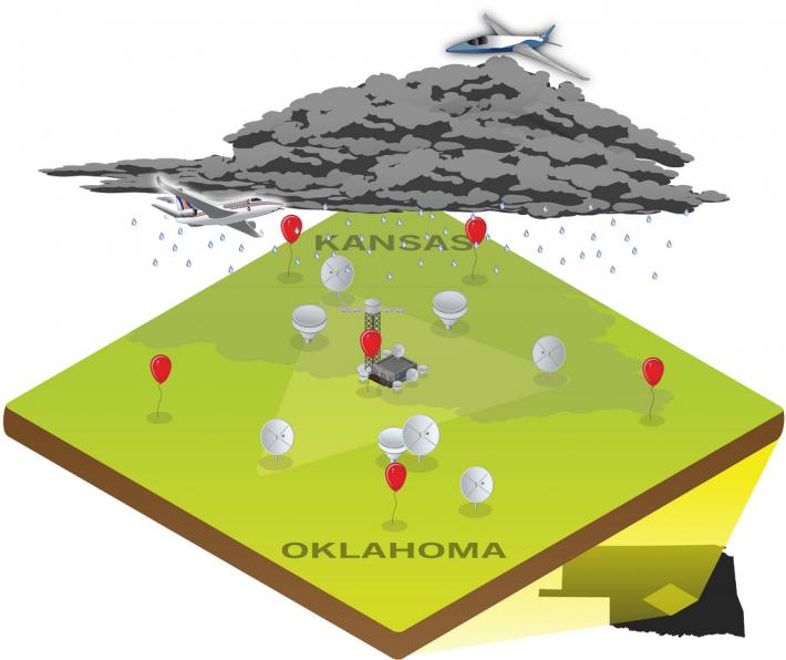
The MC3E ideal scenario captures the life cycle of a storm system. Centered at the SGP Central Facility, research aircraft fly above and within the clouds while radar systems scan through the storm from multiple locations. At the same time, additional ground-based instruments measure surface precipitation and wind speed.
GPM field campaign objectives were to collect a comprehensive set of observations describing precipitation microphysics over continents during the warm season. The observations are used to refine GPM retrieval algorithms over land. At the same time, DOE objectives focused on relating the cloud microphysical observations to accompanying observations of cloud-kinematics and the surrounding environment. These observations are used to improve the understanding and representation of cloud and precipitation microphysical interactions within cloud-resolving models.
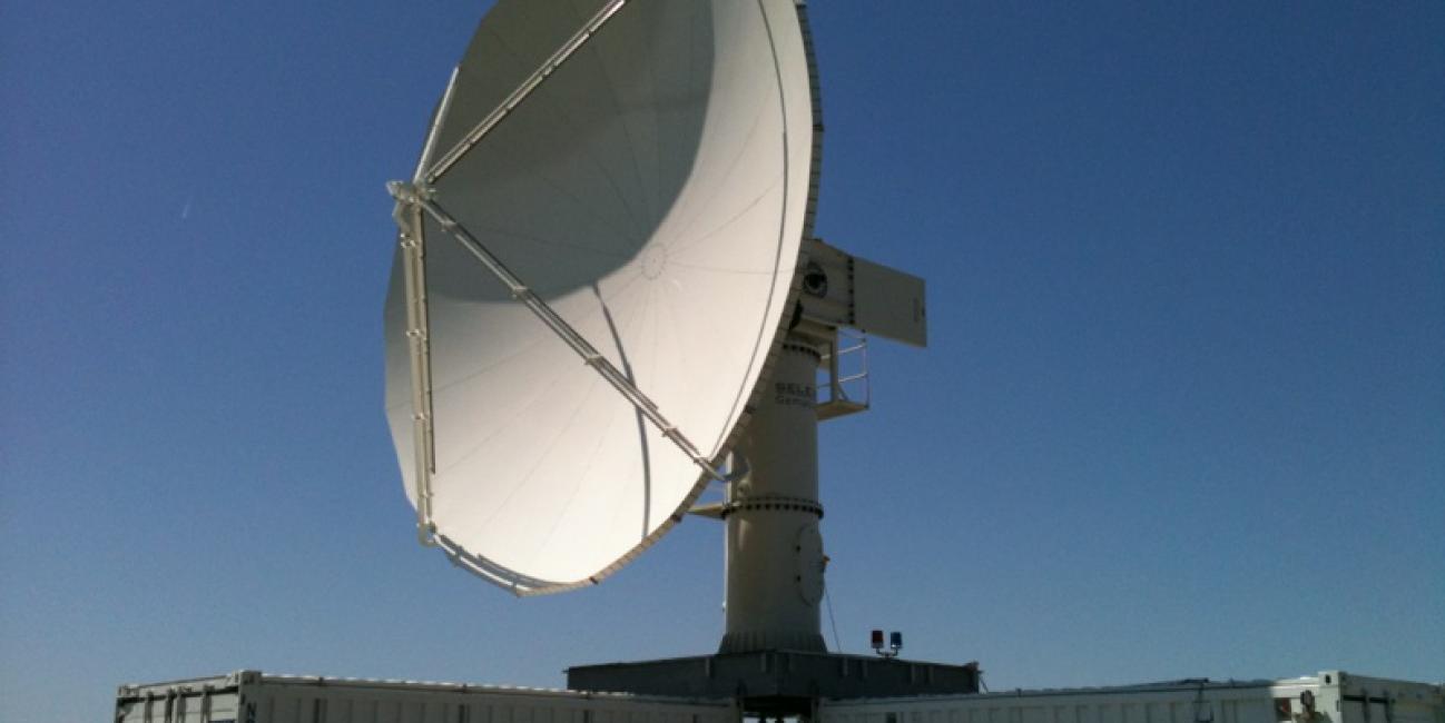
MC3E used a new, multi-scale observing strategy with the participation of a network of both passive and active sensors, The goal was to document and monitor in 3D not only precipitation, but also clouds, winds and moisture in an attempt to provide a holistic view of convective clouds, their environment and associated feedbacks. NASA and DOE deployed an extensive array of air and ground-based instrument platforms. These platforms included UND Citation (microphysical probes) aircraft, UTSI Piper (MAPIR L-band radiometer) aircraft, the NASA ER-2 (carrying the HIWRAP Ka-Ku band radar, the CoSMIR and AMPR radiometers), a suite of seven ground-based multi-frequency cloud and precipitation dual-polarimetric radars (W, Ka, Ku, X, C, S; including the NASA D3R and NPOL radars), S/UHF-band wind profilers, a dense network of rain guage pairs and disdrometers, and a six-station mesoscale rawinsonde network.
A broad variety of cloud and precipitation types were sampled during the MC3E including isolated cumulus clouds, severe thunderstorms, mesoscale convective systems and widespread regions of stratiform precipitation. A focused effort was also made to collect coordinated airborne measurements of land-surface thermal and moisture characteristics to enable study of land-surface microwave emission properties. The set of MC3E measurements are currently undergoing quality control and processing and are targeted for public release on the GPM Ground Validation Data Archive site by the end of December, 2011.
The ARM Climate Research Facility and NASA Precipitation Measurement Missions have been gathering long-term observations of clouds and precipitation for many years. MC3E was an opportunity to improve our understanding of the physics of precipitating cloud systems in the Central U.S. towards the goal of improving the modeling of these systems and the measurement of their associated rainfall from space. The lessons learned from this campaign will foster improvements in long-term remote sensing of precipitating cloud systems for both ARM and NASA GPM for many years to come.