
NASA Worldview
Friday, June 19, 2020
What is NASA Worldview?
This tool from NASA's Earth Observing System Data and Information System (EOSDIS) provides the capability to interactively browse global, full-resolution satellite imagery and then download the underlying data, including data from the Global Precipitation Measurement Missions. Many of the 600+ available products are updated within three hours of observation, essentially showing the entire Earth as it looks "right now". This supports time-critical application areas such as wildfire management, air quality measurements, and flood monitoring. Arctic and Antarctic views of several products are also available for a "full globe" perspective. Browsing on tablet and smartphone devices is generally supported for mobile access to the imagery.
Click here to launch NASA Worldview
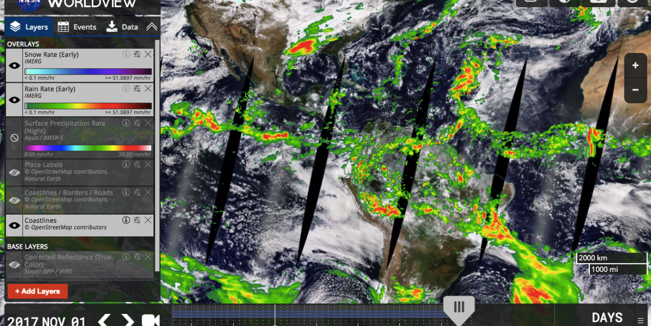
How Do I View GPM Data?
- Use the "Layer Picker" panel on the left to add and remove layers of data.
- Click the "+" (plus) icon to begin the search for a new data layer.
- Type "GPM" or "IMERG" into the search box to view the GPM-related data layers.
- For more information on using NASA Worldview, click the "i" icon in the upper right hand corner for information and tutorials.
- The GPM datasets currently available are:
- GPM Microwave Imager Brightness Temperatures (1C-GMI: Calibrated GMI brightness temperatures)
- GPM Rain Rate & Snow Rates (2A-GPROF-GMI: GMI Single-orbit Rainfall Estimates)
- IMERG "Early Run" Multi-satellite Rain & Snow Rates
- Click here to learn more about these data products