
Atmospheric River Brings Heavy Rainfall to Central California
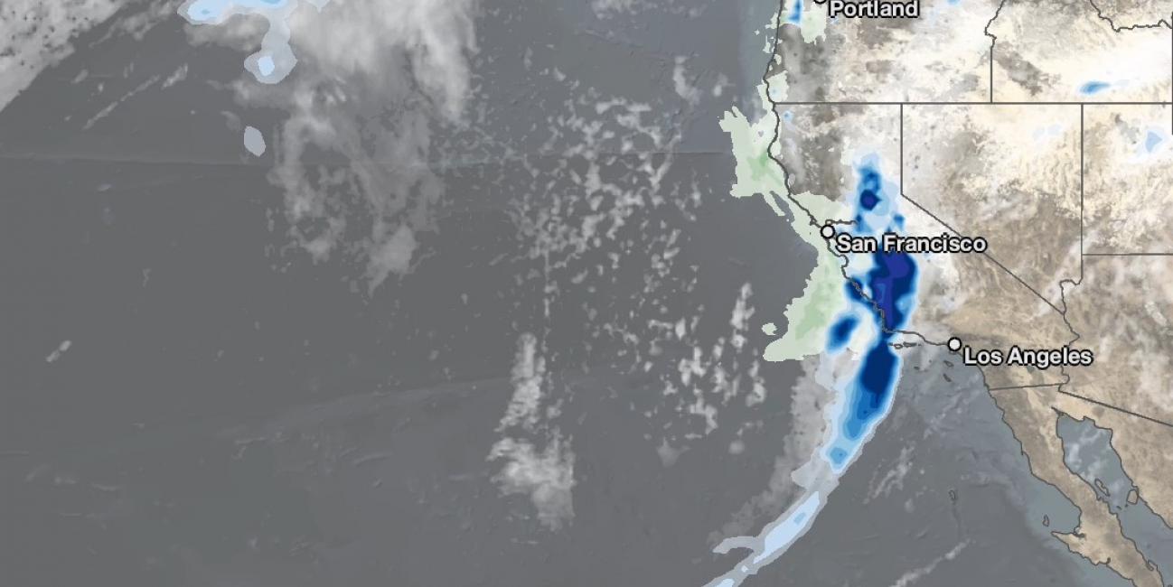
NASA combined data from multiple satellites to estimate the rainfall from an "atmospheric river" event over the U.S. West Coast in near real-time at half-hourly intervals from January 25 - 29, 2021. Atmospheric rivers are long, narrow corridors of water vapor that can lead to heavy precipitation when they encounter land. This animation shows estimated rainfall rates in blue and yellow shading and total rainfall accumulations in green shading, from NASA's IMERG algorithm, overlaid on shades of white and gray from NOAA infrared satellite data which shows cloudiness.
On January 25, 2021, a low-pressure weather system approached the U.S. West Coast. After briefly bringing rain to the Pacific Northwest, it progressed to California, where its southeastern edge tapped into sub-tropical moisture over the Pacific Ocean. A long, narrow band of rainfall was observed extending southwestward from the California coast, in a typical configuration of an atmospheric river. IMERG estimated that much of central California received over 2 inches of rainfall during this event, with areas south of San Francisco, particularly in the Big Sur region, seeing up to 14 inches at high elevations. National Weather Service observations were broadly consistent with the IMERG estimates. Atmospheric river events are responsible for a considerable percentage of winter precipitation for the U.S. West Coast, and this event was consistent with that pattern. The National Weather Service reported that, in some areas of central California, rainfall from this atmospheric river event exceeded the total precipitation accumulation since October 2020.