
GPM Examines Weakening Tropical Cyclone Kenanga
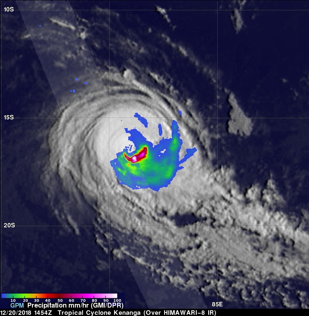
Tropical cyclone Kenanga has started to weaken as predicted. The GPM core observatory satellite had an excellent view of Kenanga on December 20, 2018 at 1454 UTC when the tropical cyclone's maximum sustained winds had decreased to about 90 kts (103.5 mph). That GPM pass also showed that the eye that was so prominent a day earlier had filled. Data collected by the satellite's Microwave Imager (GMI) and GPM's Dual-Frequency Precipitation Radar (DPR) instruments revealed through the overcast that powerful storms south of Kenanga's center of circulation were still producing very heavy rainfall. GPM's radar (DPR Ku Band) data indicated that Kenanga was dropping rain at the extreme rate of over 214 mm (8.4 inches) per hour in that part of the storm. Data collected by GPM's instruments also revealed that convective rainfall had decreased significantly in the northern half of the tropical cyclone.
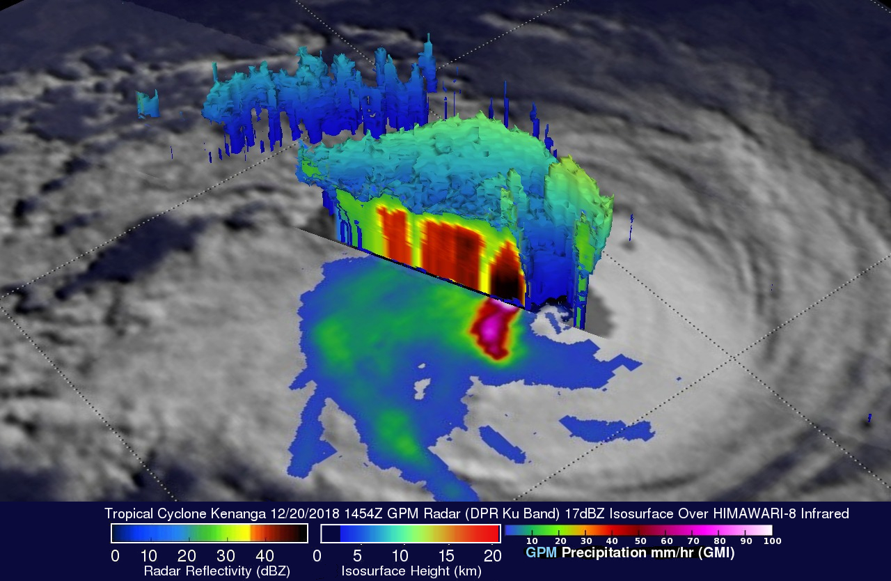
This simulated 3-D view of tropical cyclone Kenanga, looking toward the southwest, was derived from GPM's radar (DPR Ku Band) data. This image of Kenanga's rainfall structure shows that extremely powerful storms south of Kenanga's deteriorating eye wall were returning very strong reflectivity values to the satellite. GPM's radar probes revealed that storm tops in the remaining intact eyewall on the western side of the tropical cyclone were reaching heights above 12.7 km (7.9 miles).