
GPM Examines Weaker Tropical Storm Yutu in the South China Sea
Typhoon YUTU (known as Rosita in the Philippines) is now threatening the Philippine Island of Luzon. On October 24, 2018 YUTU devastated the northern Mariana Islands of Tinian and Saipan as a super typhoon. One death has been attributed to the typhoon in the Marianas with many structures including schools and hospitals being destroyed.
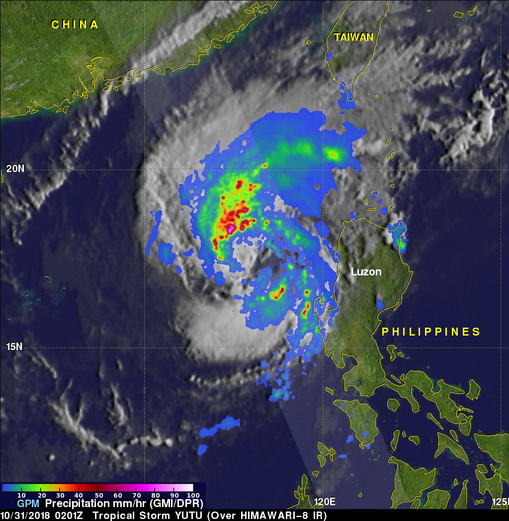
Typhoon YUTU weakened as it moved toward the Philippines and had maximum sustained winds of about 90 kts (103.5 mph) when the GPM core observatory satellite passed above the Philippine Sea on October 29, 2018 at 0212 UTC. This rainfall analysis was developed using data collected by GPM's Microwave Imager (GMI) and Dual-Frequency Precipitation Radar (DPR) instruments. Those GPM data revealed that heavy rainfall within the typhoon covered an area the size of Luzon. Extreme precipitation falling at a rate of over 178 mm (7 inches) per hour was also revealed by GPM's radar (DPR Ku Band) within powerful storms in YUTU's southwestern eye wall.
Typhoon YUTU weakened as it moved toward the Philippines and had maximum sustained winds of about 90 kts (103.5 mph) when the GPM core observatory satellite passed above the Philippine Sea on October 29, 2018 at 0212 UTC. This rainfall analysis was developed using data collected by GPM's Microwave Imager (GMI) and Dual-Frequency Precipitation Radar (DPR) instruments. Those GPM data revealed that heavy rainfall within the typhoon covered an area the size of Luzon. Extreme precipitation falling at a rate of over 178 mm (7 inches) per hour was also revealed by GPM's radar (DPR Ku Band) within powerful storms in YUTU's southwestern eye wall.
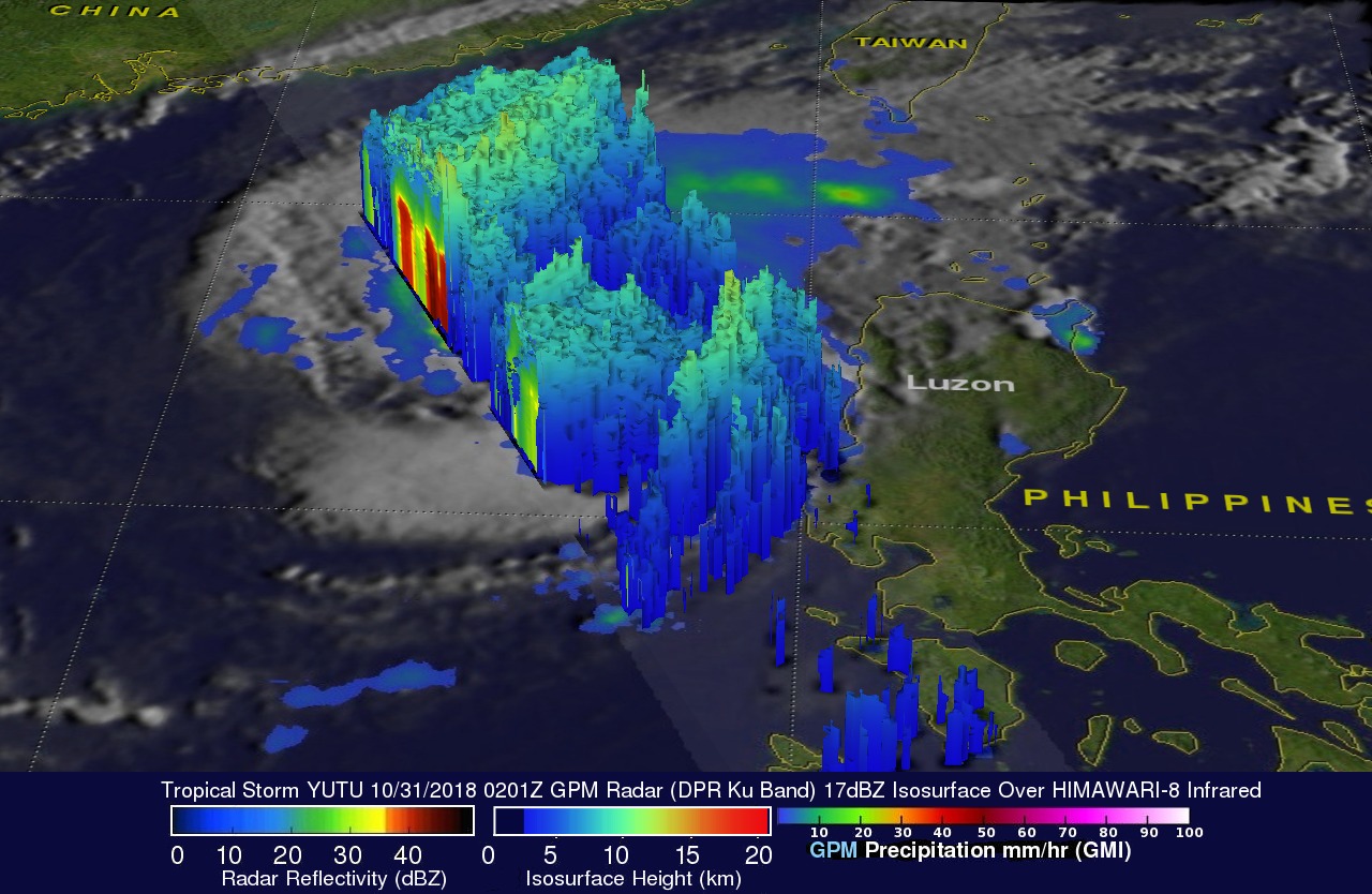
This 3-D image of typhoon YUTU's precipitation structure was derived from GPM's radar data (DPR Ku Band). This simulated close-up view, looking from the north-northeast, clearly shows the shape of precipitation within YUTU's eyewall and other bands of intense precipitation around the center of the typhoon. Storm top heights were found to reach altitudes higher than 11.8 km (7.3 miles) in powerful storms southwest of YUTU's eye.
The Joint Typhoon Warning Center (JTWC) predicts that typhoon YUTU will still be a powerful typhoon with winds of about 85 kts (98 mph) when it makes landfall in the Philippines. Interaction with the rugged terrain over Luzon is expected to cause YUTU to weaken to tropical storm intensity. YUTU is then expected to intensify to typhoon again as it moves into the South China Sea. Typhoon YUTU is then expected to re-curve to the east of Hong Kong.