GPM Observes Dangerous Super Typhoon Heading Toward The Philippines
The GPM core observatory satellite has recently provided very useful information about super typhoon MANGKHUT in the western Pacific Ocean. A few days ago MANGHUT battered the Marianas Islands. MANGKHUT's destructive winds pounded the island of GUAM causing power outages and it's extremely heavy rainfall caused flash floods.
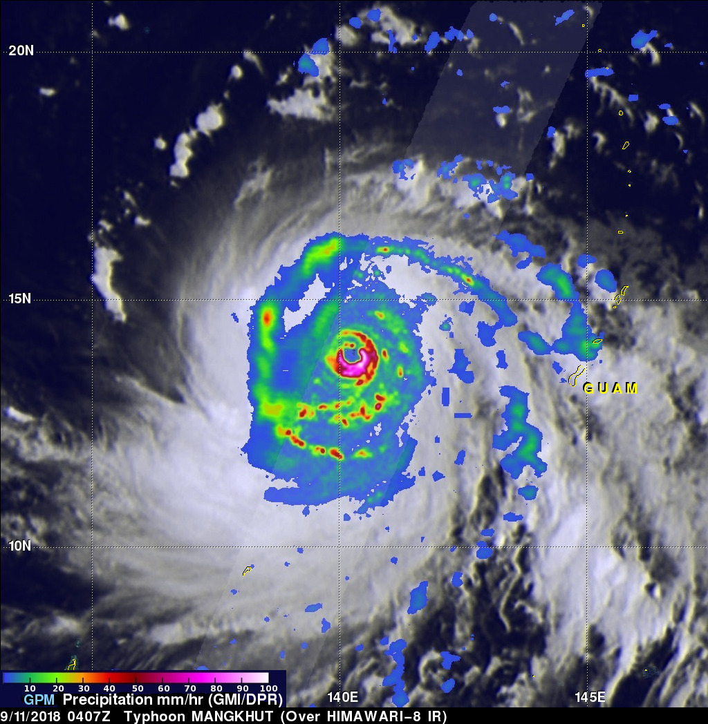
The GPM core observatory satellite passed over super typhoon MANGKHUT on September 11, 2018 at 0407 UTC when it was west of GUAM. GPM's Microwave Imager (GMI) and Dual-Frequency Precipitation Radar (DPR) collected data showing that MANGKHUT was a large and very well organized typhoon. GPM revealed that the typhoon contained multiple bands of intense rainfall. The satellite's radar (DPR Ku Band) uncloaked precipitation in MANGKHUT's eye wall that was falling at the extreme rate of over 266 mm (10.5 inches) per hour.
View Fullscreen on STORM Event Viewer
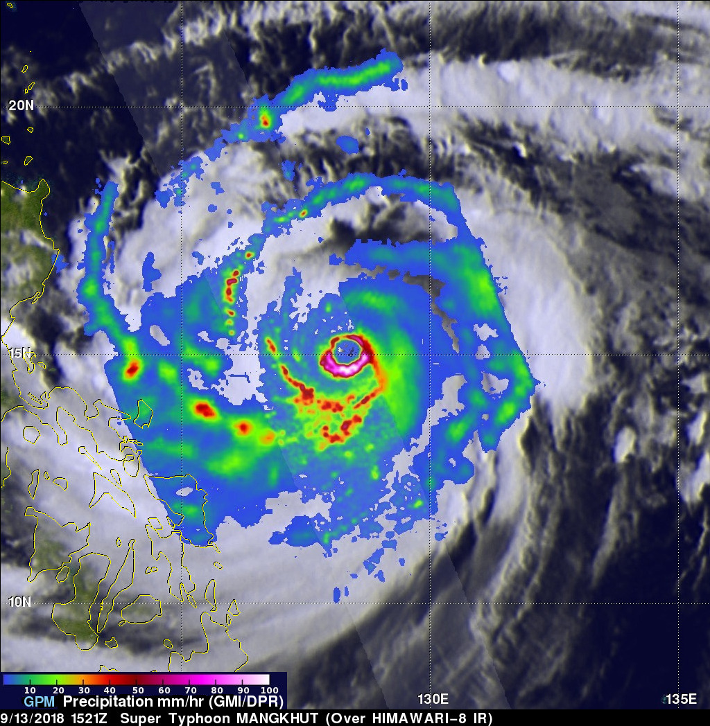
The GPM core observatory satellite again flew above super typhoon MANGKHUT on September 13, 2018 at 1521 UTC. GPM showed that the massive and powerful typhoon still had a nearly circular eye with precipitation falling at extreme rates. GPM's Dual-Frequency Precipitation Radar (DPR) measured rain falling at a rate of over 298 mm (11.7 inches) per hour in powerful storms in MANGKHUT's southern eye wall.
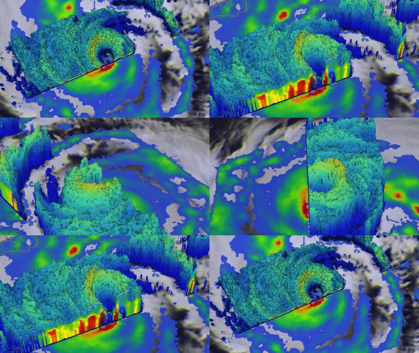
GPM's radar (DPR ku Band) data were used in this 3-D view to show the structure of precipitation within super typhoon MANGKHUT. The heights of storm tops are shown with the 17dBZ isosurface. The 3-D cross-section shows the intensity of downpours in MANGKHUT's eye wall and other rain bands.
The Philippines is preparing for the super typhoon to hit the northern island of Luzon. Extremely heavy rainfall from MANGKHUT is expected to cause flooding and landslides. MANGKHUT is expected to weaken as it interacts with Luzon's mountainous terrain but become a super typhoon again after it enters the warm waters of the South China Sea.


