
GPM Scans Tropical Storm Nadine
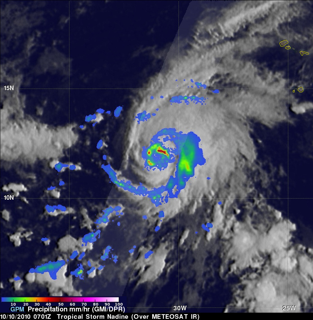
Tropical Depression fifteen was located southwest of the Cabo Verde Islands when it became tropical storm Nadine early on October 9, 2018. The GPM core observatory collected significant information about Nadine when it scanned the tropical storm's center of circulation on October 10, 2018 at 3:01 AM EDT (0701 UTC). Nadine was a small tropical storm but GPM's Microwave Imager (GMI) and Dual-Frequency Precipitation Radar (DPR) data revealed that extreme rainfall was occurring in areas around the center of the tropical cyclone. GPM's radar (DPR Ku Band) measurements indicated that rain was falling at a rate of almost 4 inches (101.6 mm ) per hour in storms moving around the western side of Nadine's center of circulation.
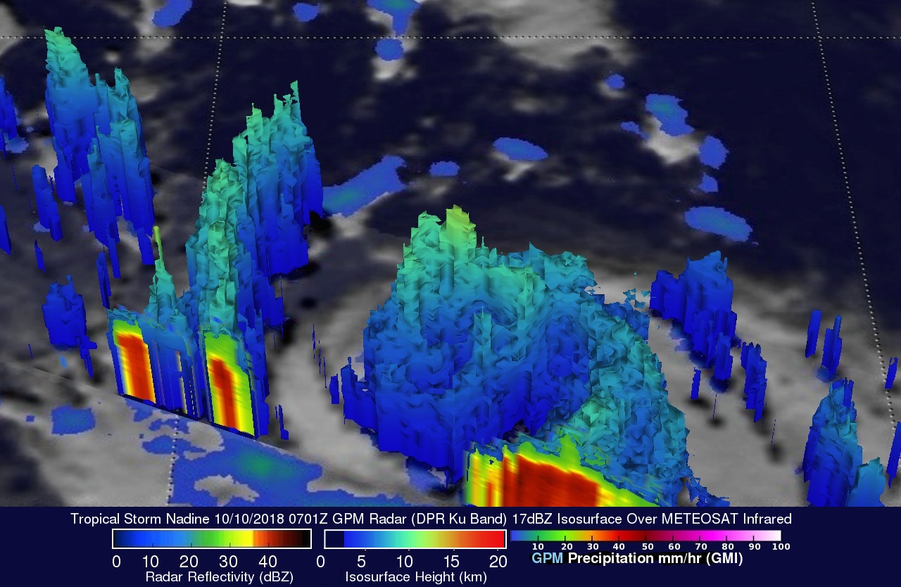
This image shows the 3-D vertical structure of precipitation within tropical storm Nadine. This simulated view, looking toward the west, was formed using data collected by GPM's radar data (DPR Ku Band). The heights of precipitation are shown using GPM's radar reflectivity 17dBZ values. The tallest storms on the western edge of Nadine's center of circulation were found by GPM's radar to reach heights of over 7.26 miles (12.3 km).
The National Hurricane Center (NHC) predicts tropical storm Nadine will move toward the northwest and dissipate on Saturday October 14, 2018 due to strong vertical wind shear.