GPM Sees Tropical Cyclone Jebi Threaten Japan
Japan has been afflicted by several tropical cyclones and other extreme weather this summer. The Joint Typhoon Warning Center (JTWC) predicts that yet another typhoon called JEBI will be approaching the main islands of Japan early next week. Warm ocean temperatures and low vertical wind shear are providing a favorable environment for JEBI's intensification. The JTWC predicts that the typhoon will have peak sustained winds of 115 kts (132 mph) as it moves over the northern Pacific Ocean toward Japan next week.

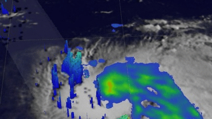
The GPM core observatory satellite passed above on August 28, 2018 at 1816 UTC when JEBI was still a tropical storm. The GPM satellite's Microwave Imager (GMI) and Dual-Frequency Precipitation Radar (DPR) instruments collected data in a swath that was centered west of tropical storm JEBI's center of circulation. The most powerful convective storms scanned by the satellite's radar were found in an intense feeder band south of JEBI's center of circulation. GPM's radar (DPR Ku Band) measured precipitation falling at a rate of over 87 mm (3.4 inches) per hour in that line of storms.
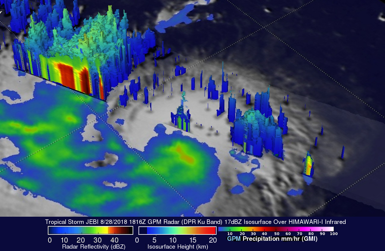
GPM's radar data (DPR Ku Band) was used here to show a simulated 3-D view of tropical storm JEBI's radar reflectivity values. This DPR view, looking toward the southwest, reveals that downpours in the feeder band south of JEBI's center were returning radar reflectivity values of over 52 dBZ to the satellite. A few of these powerful storms were found by the satellite to reach heights above 13.4 km (8.3 miles).