GPM Sees Walaka Becoming A Powerful Hurricane

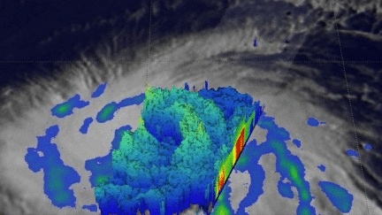
The GPM core observatory recently had a couple good looks at tropical storm Walaka as it was intensifying into a powerful hurricane. GPM passed directly over tropical storm Walaka when it was located south of the Hawaiian islands on September 30, 2018 at 8:38 AM HST (1838 UTC). Data collected by GPM's Microwave Imager (GMI) and Dual-Frequency Precipitation Radar (DPR) instruments showed that Walaka was well organized and very close to hurricane intensity. GPM's Radar (DPR Ku Band) data revealed intense convective storms in a large feeder band that was wrapping around the tropical storm's northeastern side and also storms wrapping around a forming eye wall. GPM's DPR found rain falling at a rate of almost 6.5 inches (165 mm) per hour in the intense storms in the feeder band northeast of Walaka's center of circulation.
Walaka had strengthened to hurricane intensity when GPM flew above about twelve hours later at 8:07 PM HST (October 1, 2018 0607 UTC). Walaka had developed an eye and was undergoing rapid intensification. The intensifying hurricane is passing well to the south of the Hawaiian Islands. The Joint Typhoon Warning Center (JTWC) predicts that Hurricane Walaka will continue to strengthen and re-curve to the north later today. Walaka is expected to be a powerful category four hurricane on the Saffir-Simpson wind scale when it passes just to the west of Johnson Atoll in a couple days. Walaka is not expected to have a significant affect on the Hawaiian islands.
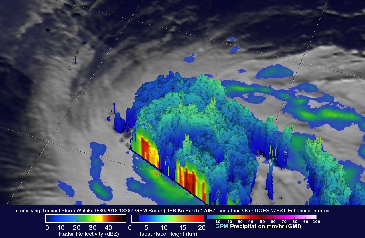
The GPM satellite's Dual-Frequency Precipitation Radar (DPR) data were used to show the structure of precipitation within intensifying tropical storm Walaka. This simulated 3-D view of Walaka, looking from the southwest, shows the the storm tops of powerful storms wrapping into the center of the tropical storm. A tall convective storm in a line northwest of Walaka's center was found by DPR to reach heights above 8.5 miles (13.7 km).