
GPM's GMI Measures Weakening Kong-Rey's Rainfall
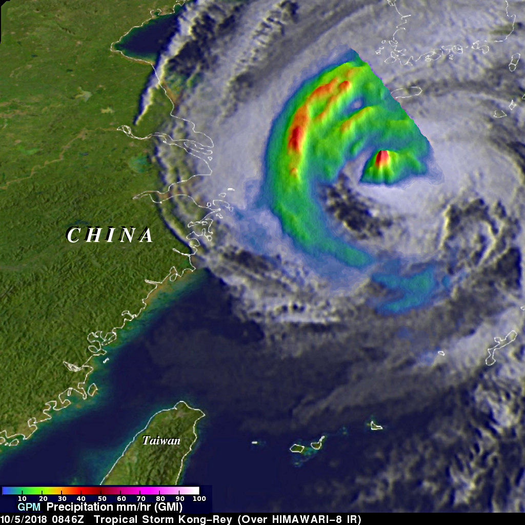
The GPM core observatory passed above tropical storm Kong-Rey on October 5, 2018 at 0846 UTC. Kong-Rey was a powerful category five typhoon just a few days ago but increased vertical wind shear and cooler sea surface temperatures have caused the tropical cyclone to weaken dramatically. Tropical storm Kong-Rey had maximum sustained winds of about 55 kts (63 mph) when it was scanned by the satellite. GPM's Microwave Imager (GMI) data were used to gauge the intensity of precipitation around Kong-Rey's center of circulation. Energy observed through clouds by GMI's microwave channels was used to estimate precipitation within the tropical storm. Those measurements indicated the rain was still falling at a rate of greater than 68 mm (2.7 inches) per hour in strong convective storms north of Kong-Rey's center of circulation.
The Joint Typhoon Warning Center (JTWC) predicts that Kong-Rey will gradually weaken as it moves quickly toward the northeast over the southern tip of South Korea. Kong-Rey's forward speed is expected to accelerate while moving over the sea Of Japan toward the Japanese island of Hokkaido. Kong-Rey is expected to transition to a extratropical low within the next couple days.