Hurricane Florence Makes Landfall, Brings Torrential Rains and Record Flooding to the Carolinas
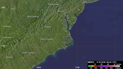
Over the weekend #HurricaneFlorence brought torrential rains and record flooding to the Carolinas. This GPM IMERG visualization shows storm-total accumulated rainfall on the left for 9/12/18 - 9/17/18 vs. a sequence of 3-hour accumulations on the right https://t.co/numzHJXzb2 pic.twitter.com/pzAgkVrRXl
— NASA Precipitation (@NASARain) September 17, 2018
After making its way across the Atlantic, Florence, a once powerful Category 4 hurricane with maximum sustained winds reported at 140 mph by the National Hurricane Center (NHC), finally made landfall early Friday morning at around 7:15 am EDT September 14th near Wrightsville Beach on the coast of North Carolina just east of Wilmington. Although it's maximum sustained winds had decreased to 90 mph when it made landfall, making it a Category 1 storm, Florence was still a very dangerous storm with a peak wind gust of 105 mph recorded at Wilmington, NC. By this time, Florence was a large storm with a large wind field. Having undergone an eyewall replacement cycle on the 11th, wherein a new eyewall forms and replaces the original inner eyewall, Florence traded some of its peak intensity for size before reaching the coast. This kept the storm surge threat high eventhough the peak winds were down. New Bern, NC was hit by a reported 10 foot storm surge, which stranded many residents. In addition to its large size, Florence also slowed down as it approached the coast, allowing a good portion of its circulation to remain over water as it slowly made its way inland. This set the stage for a major flooding event over the Carolinas and was well forecast by NHC.
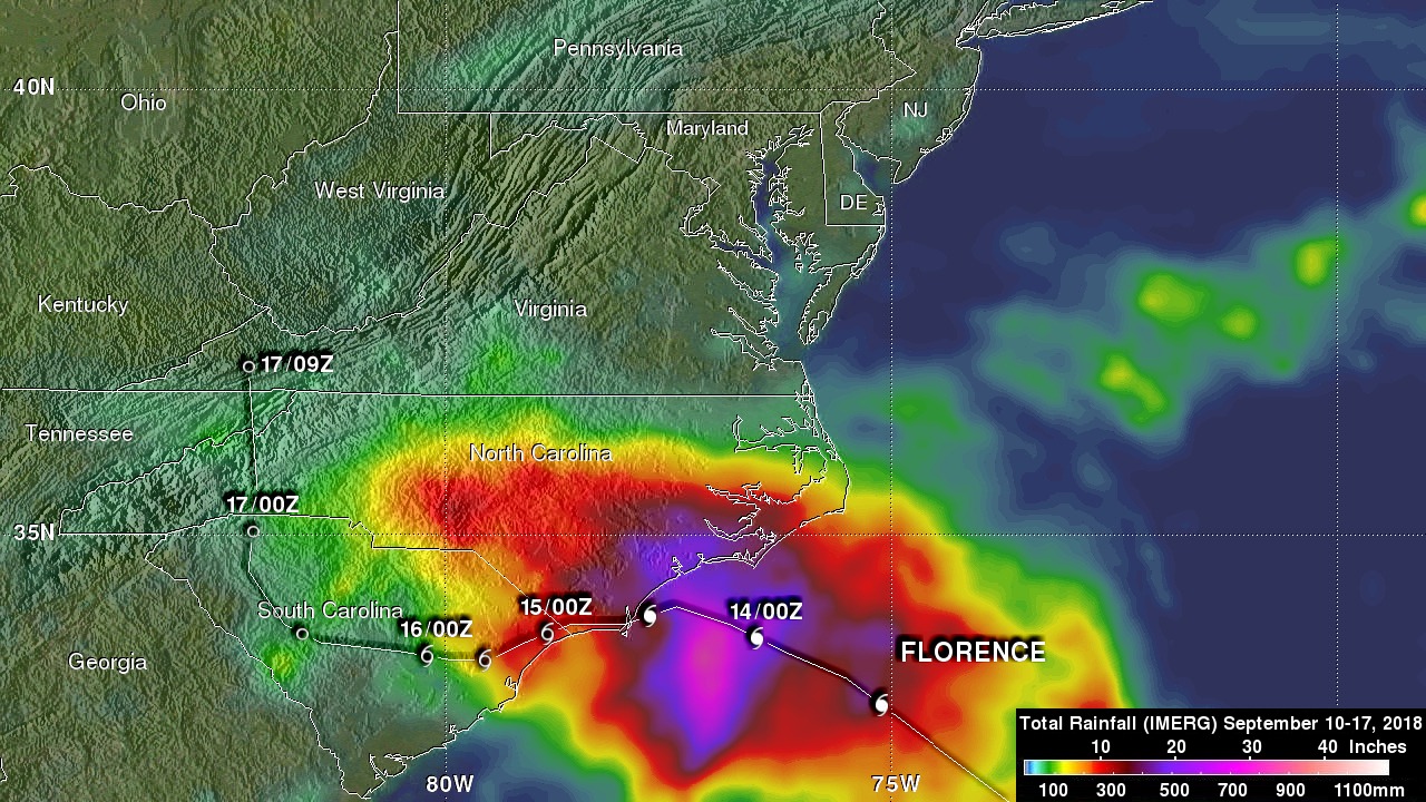
The Integrated Multi-satellitE Retrievals for GPM or IMERG is used to make estimates of precipitation from a combination of passive microwave sensors, including the GMI microwave sensor onboard the GPM satellite, and geostationary IR (infrared) data. This image shows IMERG rainfall estimates associated with Florence for the 1-week period 10 to 17 September 2018 for the central US East Coast region where the storm came ashore. IMERG estimates show on the order of 250 mm of rain (~10 inches, shown in red) or more reaching inland over most of central and southern North Carolina as well as the northeast corner of South Carolina. However, along the southeast coast of North Carolina between Cape Fear and Cape Lookout rainfall amounts are much higher. Here where peristent rainbands rotated onshore bringing continuous bands of heavy rains onto the coast, IMERG estimates are on the order of 500 mm (~20 inches, shown in purple) or more. Locally, upwards of 30 inches of rain were reported in parts of North Carolina with reports of over 35 and 33 inches in Elizabethtown and Swansboro, respectively. As a result of receiving over 26 inches of rain from Florence, Wilmington set a new yearly rainfall record. The result of all of this rain has been record or major flooding along many of the rivers in North Carolina. At one point, Wilmington, NC was reportedly cut off. So far, Florence is being blamed for 20 fatalities.