
IMERG Measures Flooding Rainfall In Deadly California Wildfire Areas
Heavy precipitation has been falling in areas of California that were recently devastated by deadly wildfires. This flooding rainfall has resulted in evacuations in burn scarred areas such as Butte County where the deadly Camp Fire hit this month. Flash floods, debris flows and mudslides are now predicted in areas where deadly wildfires stripped away vegetation. On a positive note these Pacific storms are expected to dampen wildfires and replenish the Sierra Nevada snowpack. This snowpack is an important source of water for California's streams and rivers.
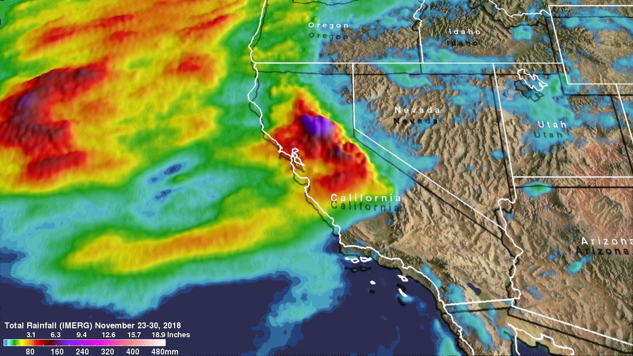
NASA's Integrated Multi-satellitE Retrievals for GPM (IMERG) data were used here to show rainfall total estimates over the western United States. Various satellites in the GPM Constellation provide data that are calibrated with measurements from the GPM Core Observatory and rain gauge networks around the world. IMERG data are generated in near-realtime at half hourly intervals by NASA's Precipitation Processing System. This analysis shows total rainfall accumulation estimates using IMERG data produced during the seven day period from November 23-30, 2018.