

IMERG Sees Flooding Rainfall in the Greek Islands from Medicane Ianos
From September 14th - 20th, 2020, NASA’s IMERG algorithm estimated the rainfall from a Mediterranean cyclone with tropical-like characteristics, commonly known as a “Medicane”, which flooded parts of Greece.
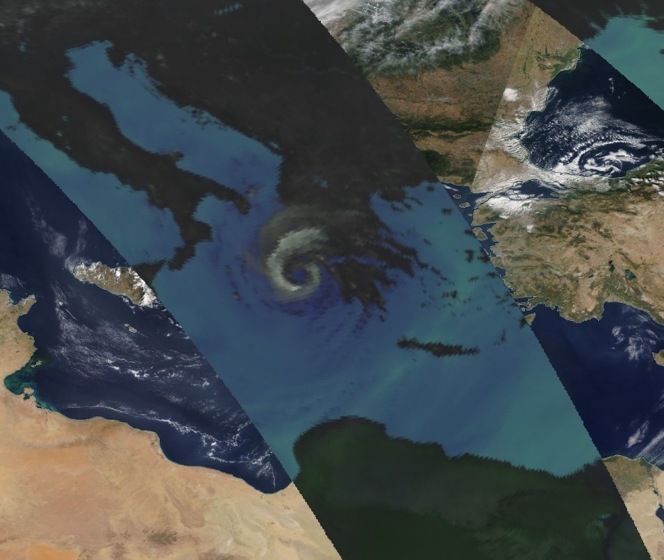
Medicanes typically appear once or twice a year and are similar to tropical storms in that both have a symmetric structure, a warm core, a clearly visible eye, and winds of at least tropical-storm strength. This particular storm system, dubbed "Ianos" by the National Observatory of Athens, led to media reports of flooding throughout the islands of Kefalonia and Zakynthos off the western coast of Greece, as well as heavy flooding in the interior of the country, including around the city of Karditsa.
In the animation above, blue/yellow shading shows IMERG rain rates throughout Ianos’ path, with yellow indicating high values (>25 millimeters/hour). White/gray shading shows cloudiness based on NOAA infrared satellite observations. Green shading shows the IMERG rain accumulations that resulted from Ianos’ passage. The yellow line shows the approximate location of the storm’s low-pressure center, based on output from NOAA’s GFS model analysis. By September 20th, 2330 UTC, IMERG estimated that Ianos left rainfall accumulations in excess of 15 centimeters (~6 inches) in central and western coastal Greece and 30 centimeters (~12 inches) in part of the Ionian Islands, in particular Kefalonia, which saw some of the highest accumulations from Ianos.
GPM overpass of Medicane Ianos on September 17th, 2020, at 2230 UTC, showing microwave brightness temperatures that indicate precipitation from the GPM Microwave Imager. Click here to view the data in NASA Worldview. Credit: Chris Kidd (NASA GSFC)
The NASA/JAXA GPM Core Observatory satellite flew over the system on September 17 at 2230 UTC, less than a day before the storm made landfall near the western coast of Greece, as shown in the image above. A clear eye-like structure was visible off the west coast of Greece in the overflight, along with heavy rain bands to its north.
Credits:
Text & animation by Jason West (NASA GSFC)
Still image by Chris Kidd (NASA GSFC)