
IMERG Sees Winter Precipitation Impact the U.S.
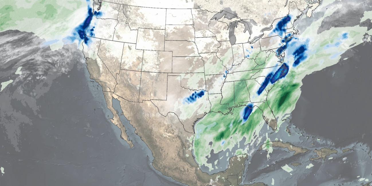
In mid-February 2021, large areas of the Continental United States experienced extreme cold temperatures as a result of a strong Arctic high pressure system. The cold temperatures were accompanied by several pulses of precipitation over the Southeast US through the mid-Atlantic, as well as the Pacific Northwest. The combination of cold temperatures and precipitation resulted in widespread power outages to millions of people in Texas, Kentucky, West Virginia, and Oregon, among other states.
Download video (right-click -> Save As)
NASA combined data from multiple satellites to estimate the precipitation from winter storms over the Continental United States in mid-February 2021. This animation shows liquid-equivalent precipitation rates (blue/yellow shading) and accumulations (green shading) at half-hourly intervals from February 11 - 18, 2021 using NASA's IMERG algorithm, overlaid on shades of white/gray from NOAA infrared satellite data which shows cloudiness. IMERG estimated liquid-equivalent accumulations of over 6 inches in parts of the Southeast U.S. and Pacific Northwest during the 8-day period of the animation, and lower accumulations throughout several states in the Central U.S. In parts of Texas, where power outages were the most severe, the National Weather Service posted observed precipitation totals from 1 - 4 inches for the week ending in February 18, broadly consistent with the IMERG estimates.
Credits:
Animation and text by Jason West (NASA GSFC)