
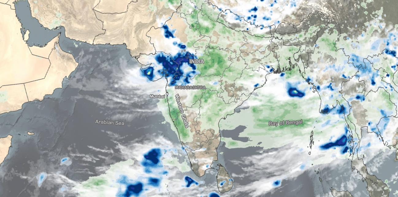
Monsoon Brings Heavy Rains, Flooding to Parts of Western India
After a relatively quiet period of below normal activity that began in the latter part of June and extended into the first half of July, and which resulted in rainfall deficits over much of India, the South Asian monsoon surged to life last week, bringing heavy rains, widespread flooding and landslides. Among the hardest hit areas was the western state of Maharashtra, which extends from the central west coast of India inland. A key geographical feature along the west coast of India is the Western Ghats. This coastal mountain range runs roughly north-south for about 1000 miles along the west coast of India. Numerous peaks reach 2 km or about 6500 ft above sea level. This mountain range is a key part of the Indian monsoon as it is the first significant terrain to intercept the moisture-laden air flowing in from the southwest off of the Northern Indian Ocean as part of the South Asian monsoon circulation. As a result, the Western Ghats are quick to feel the monsoon, and orographically-enhanced rain along the range is a common feature of the monsoon. However, the monsoon can vary from year to year as result of ENSO (the El Nino-Southern Oscillation) effects, the Indian Ocean Dipole, the Madden-Julian Oscillation, and climate trends. This year, Maharashtra has seen some of its heaviest July rainfall in decades.
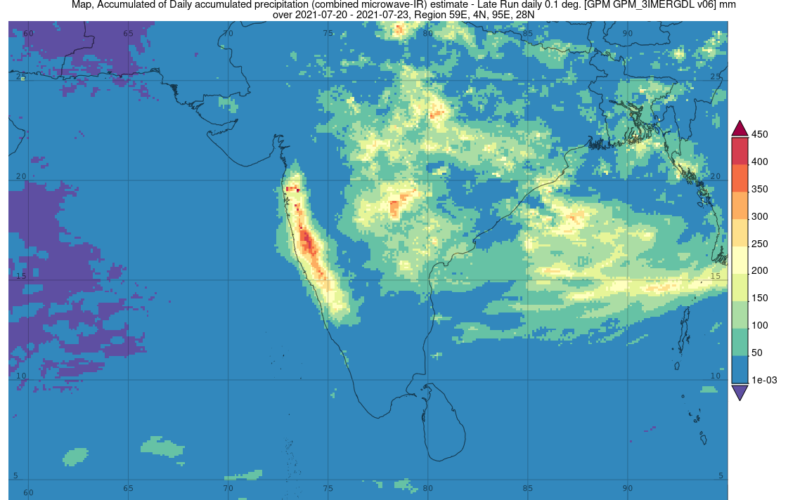
NASA’s GPM-based IMERG satellite estimates show heavy rainfall amounts of up to ~8 to 16 inches (200 to 400 mm) over parts of western India in association with the South Asian monsoon. Credits: NASA
IMERG surface rainfall accumulations are shown above for the period 20 to 23 July 2021 for India and parts of the North Indian Ocean, including the Arabian Sea and the Bay of Bengal. IMERG shows the highest rainfall totals for the period are located over the northern half of the Western Ghats where widespread of areas of 200 mm (~ 8 inches, shown in yellow) to as much as 400 mm (~16 inches) of rain are estimated to have fallen. Elsewhere over India, IMERG shows widespread areas of monsoon rains of between 100 mm (~4 inches, shown in light green) to over 300 mm (~12 inches, shown in orange) over much of the central part of the country. So far, at least 150 people have died as a result of landslides and flooding brought on by the monsoon, most in the state of Maharashtra.
The above animation shows precipitation rates (blue/yellow shading) and accumulations (green shading) at half-hourly intervals from July 19-25, 2021, derived from NASA's IMERG algorithm. Below the precipitation data, cloud cover is shown in shades of white/gray based on geosynchronous satellite infrared observations. Heavy rainfall can be seen across the Asian-Pacific Summer Monsoon region, including over India (left), Southeast Asia (center-right), and China (top). In addition, multiple tropical cyclones can be seen, including Category-2 equivalent Typhoon In-fa (upper-right), which formed over the tropical Western Pacific Ocean and made landfall over China after passing Japan’s Ryukyu Islands. The global scale and near real-time updating of NASA’s IMERG algorithm allows meteorologists to track the formation and progression of monsoons and extreme weather events, contributing to better forecasting in the future.
Credits:
Image & Story by Stephen Lang (NASA GSFC)
Animation & Caption by Jason West (NASA GSFC, NASA Precipitation Processing System (PPS), and KBR, Inc.)