
IMERG Observes Heavy Precipitation from Hurricane Melissa in Jamaica
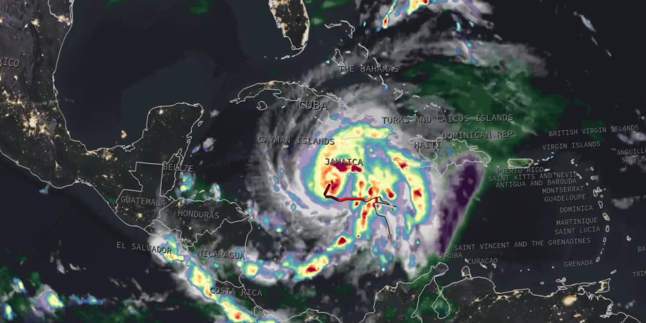
As Hurricane Melissa passed over Jamaica on Oct. 28, 2025, NASA’s IMERG algorithm provided near real-time estimates of rainfall using data from an international constellation of satellites united by the GPM Core Observatory. The below animation of IMERG precipitation rates and accumulations shows data from Oct. 23 through Oct. 29, revealing that central Jamaica received an estimated 18–24 inches of rain, much of it falling on the 28th. These satellite-based estimates were broadly consistent with the National Hurricane Center’s forecast, which anticipated 20–30 inches of rain due to the storm’s intensity, slow movement, and interaction with Jamaica’s mountainous terrain.
The IMERG animation tracks Melissa’s rainfall every 30 minutes from Oct. 23–29, capturing the evolution of the storm before, during, and after landfall. It shows areas of intense rainfall as the hurricane strengthened south of Jamaica, as well as a persistent band of precipitation east of the center that contributed to high ocean accumulations — exceeding 3 feet southeast of the island. IMERG’s ability to combine multiple satellite observations makes it especially valuable for monitoring hurricanes over both land and ocean, where ground measurements are sparse or unavailable during active disasters.
Learn more at the GMU Center for Earth Observing and Spatial Research.
Credits:
Story by Jacob Reed (NASA GSFC / Telophase Corp.)
Animation by Jason West (NASA GSFC / PPS / KBR)