
Tropical Storm Miriam's Formation Observed by GPM
Tropical cyclone's continue to regularly develop in the eastern Pacific Ocean. Tropical Depression Fifteen-E formed in the eastern Pacific Ocean about 1000 nautical miles (1852 km) southwest of the Baja California peninsula early on Sunday August 26, 2018. TD15E became better organized with increased banding later in the day and was upgraded by the National Hurricane Center (NHC) to tropical storm MIRIAM.
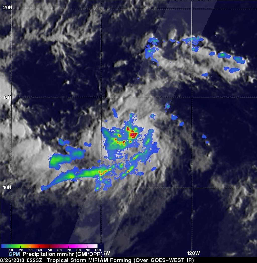
The GPM core observatory satellite saw the forming tropical storm earlier on August 26, 2018 at 0223 UTC. Heavy rainfall near the center of the forming tropical cyclone was examined with the GPM satellite's Microwave Imager (GMI) and Dual-Frequency Precipitation Radar (DPR) instruments. GPM's Radar (DPR Ku Band) revealed that extremely heavy rainfall was occurring within the organizing storm. GPM's radar measured rain falling at over 190 mm (7.5 inches) per hour in one powerful storm.
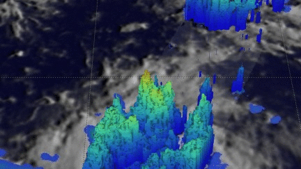
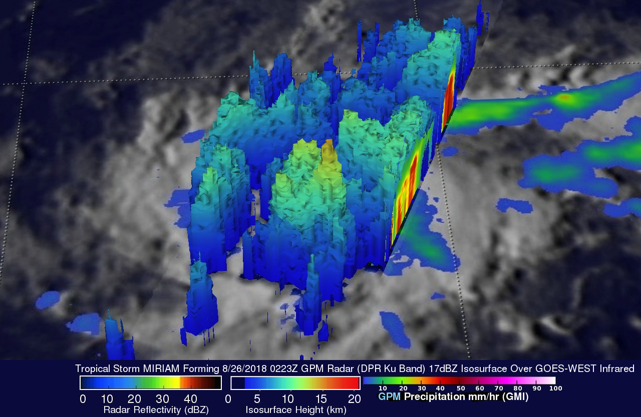
GPM's radar data (DPR Ku Band) revealed the 3-D structure of precipitation within storms in the forming tropical cyclone. The most powerful storm in this simulated 3-D view from the north-northeast was shown by GPM's radar to reach heights of about 15 km (9.3 miles). Energy, known as the latent heat of condensation, is released when precipitation occurs within these tall storms. This energy provides some of the fuel needed to form and sustain tropical cyclones.
The National Hurricane Center (NHC) predicts that MIRIAM will intensify as it moves toward the west along the southern periphery of the strong ridge to it's north. MIRIAM is expected to become a hurricane tomorrow. The hurricane is expected to make a turn to the north in a few days as it moves into the central Pacific Ocean. MIRIAM is then forecast to weaken back to tropical storm intensity on September 1, 2018.