TRMM Again Examines Energetic 92B
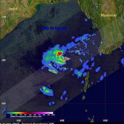
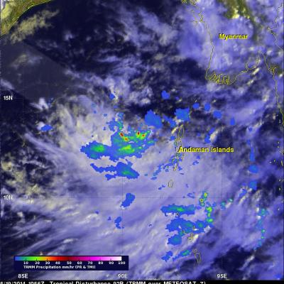
The tropical disturbance (92B) in the Bay Of Bengal was raining heavily when the TRMM satellite flew almost directly above on May 21, 2014 at 0051 UTC. TRMM's Precipitation Radar (PR) revealed that rain was falling at the extreme rate of over 191 mm/hr (about 7.5 inches) in powerful convective storms in the center of the Bay Of Bengal well to the east of India. TRMM's Precipitation Radar data were also used to construct this simulated 3-D view, looking toward the east from India, of 92B's rainfall structure. TRMM PR pulled away a veil of clouds and revealed that some powerful convective storm