cyclones

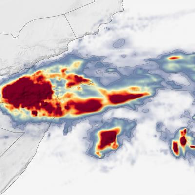
IMERG Total from Cyclone Gati
On November 22, 2020, Cyclone Gati became the strongest storm to hit Somalia since satellite records began five decades ago. Gati made landfall with maximum sustained winds of 170 kilometers (105 miles) per hour, a category 2 storm on the Saffir-Simpson scale. The storm brought more than a year’s worth of rain to the region in two days. Local authorities report at least eight people were killed and thousands have been displaced. The map above shows rainfall accumulation from November 21-23, 2020. These data are remotely-sensed estimates that come from the Integrated Multi-Satellite Retrievals

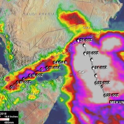
Two Cyclones Hit Somalia and Oman Within a Week

The first cyclone to strike the area, Sagar, formed from an area of thunderstorm activity located in the western Arabian Sea south of the island of Socatra. The area of low pressure associated with the thunderstorms first moved northwest into the far eastern Gulf of Aden, where it intensified into a minimal tropical storm with sustained winds estimated at 35 knots (~40 mph) by the Joint Typhoon Warning Center (JTWC), before turning west and then southwest down the middle of the Gulf. As it moved down the Gulf, Sagar slowly strengthened into a stronger tropical storm with sustained winds

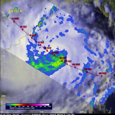
TRMM Sees Intensifying Cyclone Hudhud

The TRMM satellite flew over intensifying cyclone Hudhud in the Bay Of Bengal on October 10, 2014 at 0945 UTC.A Rainfall analysis from TRMM's Microwave Imager (TMI) instrument and Hudud's track is shown here. Cyclone Hudhud's is predicted to become a powerful category three tropical cyclone (on the Saffir-Simpson hurricane scale) with sustained winds peaking at 100 kts (115 mph) before hitting India's east coast in a couple days.