MODIS

NASA satellites used to predict zebra migrations
Of stars and stripes: NASA satellites used to predict zebra migrations One of the world's longest migrations of zebras occurs in the African nation of Botswana, but predicting when and where zebras will move has not been possible until now. Using NASA rain and vegetation data, researchers can track when and where arid lands begin to green, and for the first time anticipate if zebras will make the trek or, if the animals find poor conditions en route, understand why they will turn back. Covering an area of approximately 8,500 square miles (22,000 square kilometers), Botswana’s Okavango Delta is...

NASA Satellites Track Zebra Crossing

Submitted by JacobAdmin on Fri, 08/16/2013
Video Embed
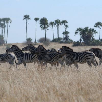
Botswana's Okavango Delta and the Makgadikgadi Salt Pans are two ends of a 360-mile round trip zebra migration, the second longest on Earth. In this animation, shades of red show dry areas, green represents vegetation, and the dots show GPS tracked zebras. The zebras begin at the Okavango Delta in late September. After the dry Southern hemisphere winter, November rains signal it is time to begin their two-week journey to the Salt Pans.