Muifa

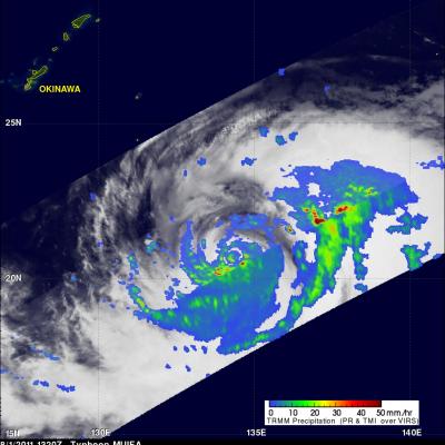
Typhoon Muifa To Affect Okinawa

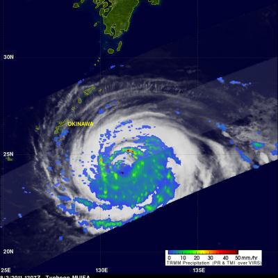
Typhoon Muifa had wind speeds of about 95 kts (~109 mph) when the TRMM satellite passed above on 3 August 2011 at 1307 UTC. Muifa is now predicted to pass just to the south of the Japanese Island of Okinawa. The southern tip of the Okinawa is expected to be in the right front quadrant of the typhoon on 5 August 2011 where the highest winds are normally located. TRMM's Microwave Imager (TMI) and Precipitation Radar (PR) data were used in the rainfall analysis shown on the right. See earlier TRMM information about typhoon Muifa.

Typhoon Muifa Heading Toward Okinawa

MUIFA was a super typhoon with wind speeds of 140 kts (~161 mph) on 30 August but wind speeds had dropped to about 110 kts (~127 mph) when it was seen by the TRMM satellite on 1 August 2011 at 1320 UTC. This TRMM orbit revealed that MUIFA had a double eyewall indicating that the typhoon was undergoing eyewall replacement with a larger eyewall shown forming farther out from a smaller inner eyewall. Muifa is expected to still be a powerful typhoon on 4 August 2011 as it passes directly over the Japanese island of Okinawa.