
GPM Satellite Sees a Windstorm over Norway

Image Caption
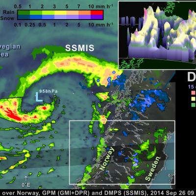
On September 26, the Global Precipitation Measurement (GPM) satellite flew over an extra-tropical cyclone whose center was approaching Norway. The Norwegian weather service reported that this storm brought gale-force winds to parts of Norway's coast.
Extra-tropical cyclones this strong or stronger are a regular feature of northern European winters. The particularly damaging ones are called "windstorms." Borrowing a page from hurricane forecasters, some weather agencies in affected countries name these storms. In fact, one such naming system called the September 26 extra-tropical cyclone "Irina" (Institute for Meteorology at the Free University of Berlin, http://www.met.fu-berlin.de/adopt-a-vortex/tief/).