
Tropical Storm Rachel
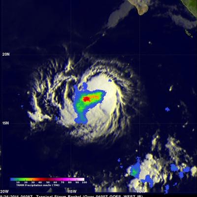
Tropical depression 18E, located southwest of Mexico, became tropical storm Rachel on September 24, 2014 at 1500 UTC (8 PM PDT). The TRMM satellite had a good view of Rachel when it flew over early today at 0608 UTC (September 25, 2014 at 11:08 PM PDT). A precipitation analysis that used TRMM's Microwave Imager (TMI) data is shown overlaid on a 0600Z GOES-WEST enhanced infrared image. This image shows that, due to northeasterly wind shear, convective precipitation was located southwest of of Rachel's center of circulation. The heaviest rain was shown falling at a rate of over 50mm (amost 2