radiometer

Getting the Big Picture: Remote Sensing

Submitted by JacobAdmin on Thu, 11/12/2015
Video Embed

A brief animated look at the different types of remote sensing techniques that NASA uses to study the Earth. This video discusses why we need remote sensing to study the Earth, and the differences between active and passive remote sensing from satellites. It also gives examples of different types of data NASA satellites collect about the Earth, and some of the applications of that data.

This video is public domain and can be downloaded in high resolution here.


Updated GPM Radiometer Products

The Precipitation Processing System (PPS) has begun producing updated GPM radiometer products as of 12/4/2014 due to an error discovered in the calculation of the Sun Angle in the PPS Geolocation Toolkit. This is considered a minor update with the Product Version being incremented in letter only. Please see the list of affected products here: http://pps.gsfc.nasa.gov/Documents/GPM_PPS_SunAngle_Products_20141204.p… For most radiometers the sun angle is used as ancillary information, but for the TRMM microwave imager (TMI) the correction also slightly impacts brightness temperature and
Date Last Updated
April 1st, 2016
Document Description

Level 1C (L1C) algorithms are a collection of algorithms that produce common calibrated brightness temperature products for the Global Precipitation Measurement (GPM) Core and Constellation satellites.

This document describes the GPM Level 1C algorithms. It consists of physical and mathematical bases for orbitization, satellite intercalibration, and quality control, as well as the software architecture and implementation for the Level 1C algorithms.

File Downloads
Document Description

The GPM Combined Radar-Radiometer Algorithm performs two basic functions: first, it provides, in principle, the most accurate, high resolution estimates of surface rainfall rate and precipitation vertical precipitation distributions that can be achieved from a spaceborne platform, and it is therefore valuable for applications where information regarding instantaneous storm structure are vital.

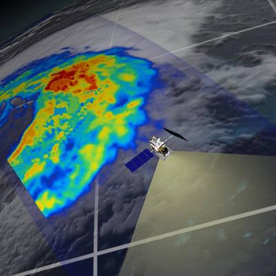
GPM flying over Earth with a data swath visualized.
Precipitation radiometers provide additional degrees of freedom for interpreting rain and snow in clouds through the use of multiple passive frequencies (9 for TRMM and 13 for GPM). Brightness temperatures at each frequency are a measure of everything in their field of view. These frequencies from the low (10 GHz) end to the high (183 GHz) end transition from being sensitive to liquid rain drops to being sensitive to the snow and ice particles. So, simplifying, when there is liquid rain in the cloud column, the low frequency channels will respond; when there is snow the high frequency channels...
GPM flying over Earth with a data swath visualized.
The combined use of coincident active and passive microwave sensor data provides complementary information about the macro and microphysical processes of precipitating clouds which can be used to reduce uncertainties in combined radar/radiometer retrieval algorithms. In simple terms, the combined algorithms use the radiometer signal as a constraint on the attenuation seen by the radar. The combined retrievals produce a hydrometeor profile, particle size distribution and surface parameters for which brightness temperatures and reflectivities are consistent with the actual satellite measurements...