supertyphoons

GPM Catches Typhoon Yutu Making Landfall
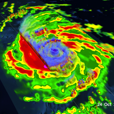
NASA's GPM Core observatory satellite captured an image of Super Typhoon Yutu when it flew over the powerful storm just as the center was striking the central Northern Mariana Islands north of Guam. Early Thursday, Oct. 25 local time, Super Typhoon Yutu crossed over the U.S. commonwealth of the Northern Mariana Islands. It was the equivalent of a Category 5 hurricane. The National Weather Service in Guam said it was the strongest storm to hit any part of the U.S. this year. Download this video in high resolution from the NASA Goddard Scientific Visualization Studio Download video without...

GPM IMERG Adds Up Heavy Rainfall from Typhoon Mangkhut

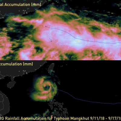
#NASA 's GPM IMERG data product was used to estimate the devastating heavy rainfall that fell on China and the Philippines from #TyphoonMangkhut . This video shows storm-total and 3-hourly precipitation accumulations from 9/11/17 - 9/17/18. Learn more: https://t.co/8PzhK9pCDW pic.twitter.com/x6gf6N8VWH — NASA Precipitation (@NASARain) September 18, 2018 In the past week, Typhoon Mangkhut has affected the Philippines, mainland China, and Hong Kong, as shown in this 7-day animation of NASA's satellite-based IMERG precipitation product. The upper frame shows the storm-total accumulation starting

Widespread Rainfall With Super Typhoon Vongfong

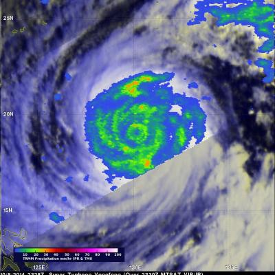
Vongfong was a super typhoon with wind maximum sustained winds of 145 kts (167 mph) when the TRMM satellite flew over on October 8, 2014 at 2328 UTC. Vongfong was the most powerful typhoon since super typhoon Haiyan that killed over 6,000 people after hitting the Philippines in November 2013. In the first image TRMM's Microwave Imager (TMI) shows that Vongfong was producing rainfall over a large area with heavy rainfall revealed in the eye wall and in multiple feeder bands. The small animation shows typhoon Vongfong's rainfall being overlaid on a MTSAT Visible/Infrared image. The Joint Typhoon