USA

NASA Examines Deadly Spring-Like Weather With GPM Satellite JacobAdmin Thu, 03/09/2017
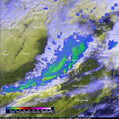
Rainfall from spring-like downpours in the U.S. from February 25 to March 1 were analyzed at NASA using data from the Global Precipitation Measurement mission or GPM satellite. This GPM rainfall image combined with infrared cloud data from NOAA's GOES-West satellite shows the line of storms that stretched from Pennsylvania to Alabama on March 1, 2017. Red areas indicate rainfall up to 50 mm per hour. Record breaking warm temperatures this winter have caused plants to bloom early in the eastern United States. Unfortunately this has also resulted in the formation of spring-like severe
California's Rainfall Analyzed From Space JacobAdmin Thu, 12/04/2014
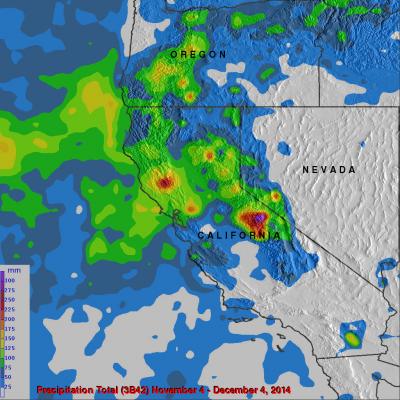
It has been very dry in the state of California for the past couple years. The lack of rain in 2013 and 2014 contributed to exceptional drought conditions in the state. Records were set over the past winter for the lowest winter snow packs recorded in a century. Rainfall produced by storms moving into California from the Pacific Ocean has recently brought some very temporary drought relief. Precipitation data (3B42) from various satellites such as TRMM and recently the GPM core observatory satellite have been collected, merged and archived at the Goddard Space Flight Center since 1998. The

Spring Storms Hit Great Plains

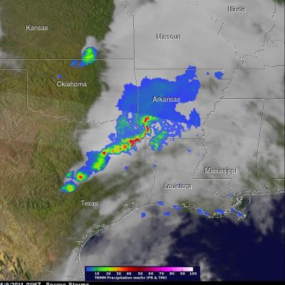
Severe weather was extending from Minnesota to southern Texas on Thursday afternoon and Friday morning. During that time there were three tornadoes reported in Minnesota, two in Colorado and two in Missouri. The TRMM satellite flew above tornado spawning thunderstorms in the southern United States on May 9, 2014 at 0115 UTC (May 8, 2014 at 8:15 PM CTD). A rainfall analysis from TRMM's Precipitation Radar (PR) and Microwave Imager (TMI) is shown overlaid on a GOES-EAST infrared image received at the same time. TRMM's PR instrument found rain falling at a rate of over almost 163 mm/hr (about 6.4