TRMM Sees Powerful Typhoon Utor As It Neared China
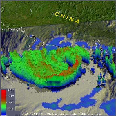
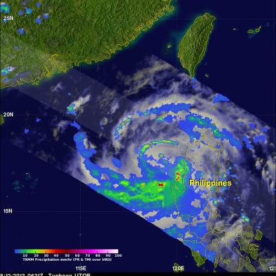
Torrential rain and powerful winds accompanied typhoon Utor when it came ashore in southern China's Guangdong province. The TRMM satellite flew above as typhoon Utor was headed toward southern China on August 13, 2013 at 2156 UTC. At the time of this TRMM pass typhoon Utor was a powerful typhoon with wind speeds reaching over 85kts (~98mph). A rainfall analysis from TRMM's Microwave Imager (TMI) and Precipitation Radar (PR) instruments is shown overlaid on an infrared image from TRMM's Visible and InfraRed Scanner (VIRS). Bands of intense rainfall are shown spiraling into the eye that was