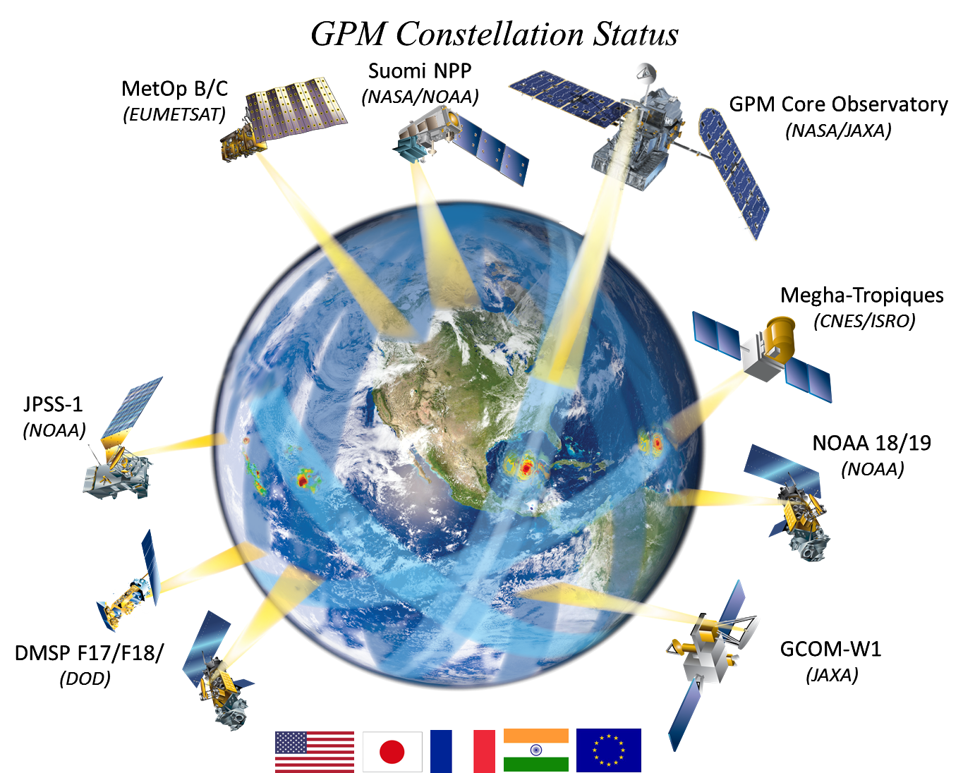
GPM Constellation 1-31-2017

(updated 1/31/2017)
Multimedia content

(updated 1/31/2017)
After more than four years of drought, Californians may wonder where the current rain is coming from. Using satellites, NASA scientists have a unique view of the sources of precipitation, and how it reaches the western United States.
Precipitation (falling rain and snow) is our fresh water reservoir in the sky and is fundamental to life on Earth. A Global Tour of Precipitation from NASA shows how rain and snowfall moves around the world from the vantage of space using measurements from the Global Precipitation Measurement Core Observatory, or GPM.
Not all raindrops are created equal. The size of falling raindrops depends on several factors, including where the cloud producing the drops is located on the globe and where the drops originate in the cloud. For the first time, scientists have three-dimensional snapshots of raindrops and snowflakes around the world from space, thanks to the joint NASA and Japan Aerospace Exploration Agency Global Precipitation Measurement (GPM) mission.
The Global Precipitation Measurement (GPM) mission core satellite provided many views of Tropical Cyclone Kilo over its very long life. GPM is a satellite co-managed by NASA and the Japan Aerospace Exploration Agency that has the ability to analyze rainfall and cloud heights. GPM was able to provide data on Kilo over its 21 day life-span.
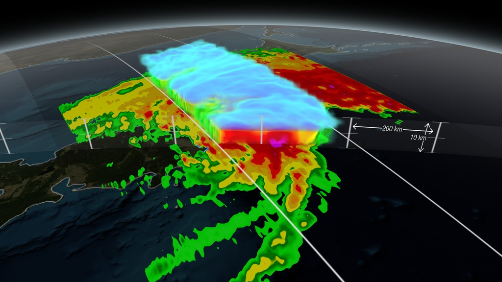
At 5:05 p.m. EST Monday, Jan. 26, 2015, the Global Precipitation Measurement mission's Core Observatory flew over the Nor'easter that dumped snow on New England. This satellite image shows the rate of rainfall, with low amounts in green and high in red, and snowfall, in blue to purple. The center of the storm, shown in 3-D, was offshore with far reaching bands of snowfall. More intense snow rates are shown in darker blue, which can be seen on the northern edge of the storm.


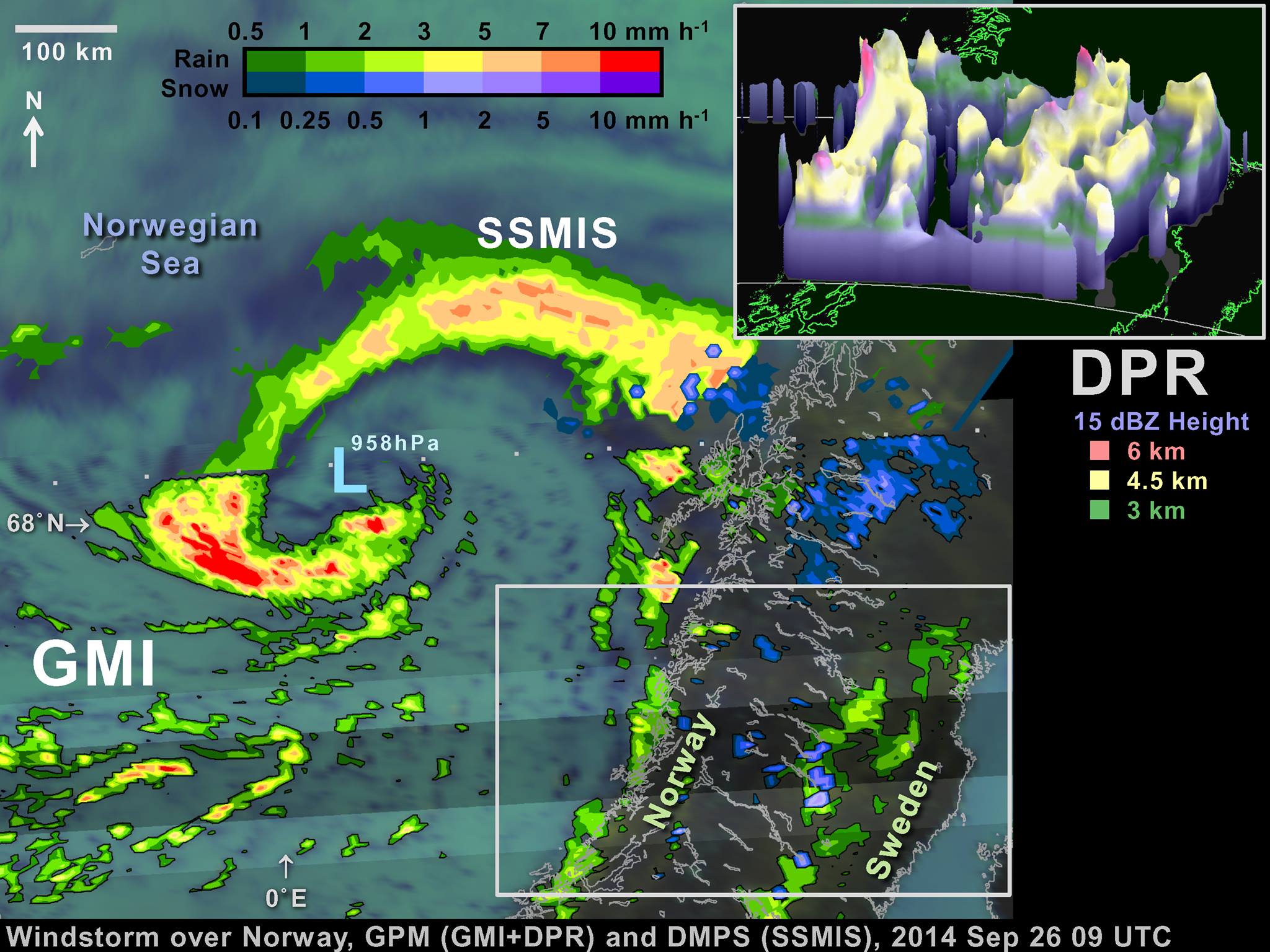
Extra-tropical cyclones this strong or stronger are a regular feature of northern European winters. The particularly damaging ones are called "windstorms." Borrowing a page from hurricane forecasters, some weather agencies in affected countries name these storms. In fact, one such naming system called the September 26 extra-tropical cyclone "Irina" (Institute for Meteorology at the Free University of Berlin, http://www.met.fu-berlin.de/adopt-a-vortex/tief/).
A video describing how the GPM constellation turns observed radiances and reflectivities of global precipitation into data products.
For more information visit http://www.nasa.gov/content/goddard/g...
One of the first storms observed by the NASA/JAXA GPM Core Observatory on March 17, 2014, in the eastern United States revealed a full range of precipitation, from rain to snow.
Download this video in HD formats from NASA Goddard's Scientific Visualization Studio